Abstract – The necessity to recognize the subsurface or underground and all its current and potential uses as part of our urban environment, to integrate this into urban planning and governance, and to foster conscious allocation of subsurface space has been increasingly recognized over the last century.
At the same time, systems thinking as a ‘buzz-word’ has gained relevance for approaching complex problem areas in all kinds of disciplines including those preoccupied with the subsurface.
This paper reviews the literature about urban underground planning through a systems-lens. To set this in context, it is outlined how organizational principles for the urban subsurface have evolved, and the main aspects of systems thinking are introduced followed by a discussion of how this thinking could be applied to the urban underground. Strategies and tools presented in the recent literature in the field are then reviewed based on this perspective, asking how systemic the proposed strategies and tools are when the local geology, as well as legal and institutional settings are accepted as a baseline for analysis or intervention. Systemic approaches built on this premise have the potential to capture existing and evolving complexities, foster a better understanding of the value of subsurface space for a city and ultimately enable an efficient and fair allocation of underground space. However, propositions for holistic solutions remain dispersed, interventions often remain based in an engineering mindset, and a shift in mind-set remains a challenge. More research in collaboration with local and regional administrations or authorities based on systems thinking frameworks could help to facilitate this shift.
Keywords
Systems thinking
Urban underground space
Underground space governance
Subsurface planning and management
1. Introduction
The subsurface or underground1 is part of our urban environment. Infrastructures, water, developments, natural and man-made cavities – all these are connected to the history and economy of a specific city or urban area. The geology sets conditions for the construction of buildings and infrastructure, predetermines prospects of future subsurface utilization (Hunt et al., 2016) and human interventions, in particular in the deep subsurface, can change these conditions permanently and irreversibly (Rogers et al., 2012).
On the one hand, the subsurface is omnipresent in current policy debates. Subjects like flood prevention, renewable energy, infrastructure, and housing all imply a claim on using or protecting subsurface space (von der Tann, Metje, Admiraal, & Collins, 2018). On the other hand, each function or service occupying subsurface space is governed separately and on a project-by-project basis (Duffaut and Labbé 1992), with some even not being regulated at all. Internationally, regulation for shallow geothermal energy for example is scarce (Haehnlein et al., 2010). The integration of the complexity of specific projects with the aim to gain an overarching understanding of the role of the subsurface for urban development and to develop strategies that ensure its sustainable use remains a major challenge: engineers still mainly act in project design and implementation and may not be consulted earlier in the process of project development. The engineering of the projects is often highly complex in itself and needs the engineers’ full commitment. For the management of these projects, holistic approaches such as systems engineering (see for example Ziv et al., 2021), gain more importance, but the long-term influence of these projects on cities is still poorly understood. Other effects such as the environmental impacts or consequences of physical interventions on future planning needs and opportunities remain somewhat disregarded (Suri and Admiraal, 2015) and thus have to be dealt with when they appear. One example for this is the extensive pumping of groundwater for industrial purposes, to dewater mines or to reclaim land, that leads to an overall lowering of the groundwater table. Today, as the industry has moved out of the cities and a lot of former mines are closed, groundwater tables are tending to rise since continued pumping of the groundwater is not sustainable. This in turn can cause all kinds of problems that have to be actively managed (Dean and Sholley, 2006). The result of the lack of foresight with regard to wider and long-term effects of underground use, is urban underground space being described as a chaotic, unregulated space, the use of which is following a first come first served rule (Duffaut and Labbe, 1992, Bobylev, 2009).
The situation is even more complex in large old cities in which the current use structure of the underground has developed over the last centuries in a piecemeal manner (Rogers et al., 2012) leading to increasingly complicated underground constructions and constrained conditions for access to deeper levels (Rogers, 2009). Understanding of the interdependencies of subsurface utilisation and above ground urban life as well as the information about the subsurface are limited and cities with a coherent planning strategy for subsurface assets and functions remain few (Sterling et al., 2012, Price et al., 2016).
More systematic approaches to planning or management of the urban underground have been claimed repeatedly for some time alongside a more general progression towards description and analysis of cities as systems (e.g. Moffat and Kohler, 2008). The Franco-Armenian architect Utudjian already in 1933 founded the Group of Studies and Coordination of Underground Urbanism (GECUS) (Heim de Balsac, 1985). Since then, the relevance of the subsurface for urban development in general and for urban sustainability in particular as well as the potential benefits a more conscious approach to managing the subsurface could entail, have been increasingly addressed, mainly by tunneling and geotechnical engineers but more recently also by geologists, urban planners and lawyers (e.g. Admiraal and Cornaro, 2016, Bobylev, 2009, de Mulder et al., 2012, Delmastro et al., 2016, Hunt et al., 2016, National Research Council, 2013, Parker, 2004, Price et al., 2016, Reynolds and Reynolds, 2015, Sandberg, 2003). The development of urban geology as an independent discipline since the mid-eighties (de Mulder, 1996), a growing number of research projects in the area,2 and current political efforts in a range of countries further stress the need to better understand the role of the subsurface with all its facets for the development of an urban area and its relationship with environmental change. The risks and opportunities of utilizing the subsurface for different functions need to be considered in terms of this background.
This review paper will first present a brief overview of the history of underground utilization connected to urban settlements and summarize seminal papers in the field. Background on earlier planning suggestions and discussions is provided here covering the period up to the end of the 20th century. System approaches are introduced as approaches to design, observe or analyse, and consequently steer systems that shift the focus of analysis and understanding of the world around us from constituent technical and controllable parts to interrelations and dependencies, processes and changes over time as well as the role of human actors and society for the development and continuous renewal of sustainable technical solutions. Current research into the urban underground and its role as a complex system or cluster of systems supporting the overall city is reviewed and it is reflected about how the proposed approaches for subsurface management and planning contribute to a more systemic understanding of the complexity of the human-technical-environmental system urban underground space. The paper is concluded with a discussion of current developments in Singapore and the Netherlands as two examples of how these challenges are approached on public policy level.
2. Background
2.1. Evolution of underground space uses and needs
Uses of underground space in urban areas developed gradually over time and many of the problems facing better planning of a city’s subsurface today stem from the lack of planning of prior underground uses or foresight with regard to their wider implications (Admiraal and Cornaro, 2018). Over the last centuries, the use of underground space in urban areas typically was not planned in an active manner but the space was rather used reactively with cities responding to pressing problems or the development of new technologies. Table 1 provides a brief summary of the way in which specific and limited early uses of the underground have evolved into the geometrically complex arrangements in the subsurface of major urban areas today. No specific dates are given for the different periods because this evolution is not linear and is still ongoing and there can be significant overlap among the categories. Different elements of underground use have appeared at different times in different parts of the world and a comprehensive list of urban underground structuresand systems embedded in the subsurface that are made or utilized by humans in the increasingly urbanised world would go beyond the scope of this paper. The intent rather is to show how urban areas have gradually used more and more underground space but only recently are realizing that it must be planned and managed as the complex system it has become. This applies in particular to but is not limited to dense cities where an increasing number of engineered structures – developments and transport systems – form a material part of the cities’ built environment and identity.
Table 1. Evolution of underground space uses and needs.
| Generalized time frame | Typical uses of underground space | Potential issues and needs for planning | Example(s); Reference(s) |
|---|---|---|---|
| Earliest uses. | Early humans appear to have identified advantageous natural geologic features for shelter and protection (e.g. in natural caves). | Unknown but structural stability of the cave, potential for flooding, and perhaps the possibility to displace any existing occupants are likely to have been key selection parameters. | Misliya Cave, Israel, (177 000 to 194 000 years ago) Hershkovitz et al. (2018). |
| Human settlements form and grow; underground space uses diversify. | Shelters and storage created in suitable rock layers (e.g. Cappadocia or Tunisia) or in semi-underground pit dwellings in soil (e.g. Banpo site, China). Climate protection and defensive characteristics are key attributes. Underground spaces were used for rituals and burials in addition to shelter (e.g. Lascaux Caves). In flatter topographies, crude drainage systems were incorporated into the streets of ancient cities (e.g. Troy). | The development and use of tools to excavate soil and rock allowed the recovery of useful minerals (e.g. flint, salt) and the possibility to excavate shelter spaces. Usage must have involved identification of the suitable geologic materials/topography and probably trial and error approaches to cavern spans, shapes and spacings in different materials. | Lascaux Caves (since 20 000 years ago); Banpo Site, China (6 000 years ago); China’s Museums (n.d.) Kaymakli, Cappadocia (from 7th to 8th century BCE through the Byzantine era). |
| From the Egyptians, Greeks and Romans up to the industrial revolution. | With widespread availability of building materials (e.g. adobe, brick or tile) and use of timber for construction, village, town and city development focused on aboveground structures. Underground structures (particularly tunnels) are important for some transportation purposes and water supply (e.g. Greek and Roman tunnels) although many cities simply rely on access to rivers. Sanitation mainly relies on cesspools and/or surface or near-surface drainage to rivers and seas. | The importance of the ground as a foundation layer increases. Few spatial conflicts in underground uses. In some cities (e.g. Paris) the building materials are taken from local mining/quarrying – creating a largely unplanned system of underground caverns beneath the city. | Ancient sewers in Mesopotamia (from 4 000 to 2 500 BCE) Sewerhistory.org, 2018; Eupalinos’ Tunnel 6th Century BCE; Fucine Lake drainage tunnel, Italy (begun 41 CE) (Iisgalilei, 2014); First tunneled sewer in Paris in 1370 Paris-Musées (1997). |
| Through the industrial revolution. | Villages and towns of modest size use little subsurface space – mainly perhaps for a piped water supply or for surface water drainage. The industrial revolution stimulates the growth of cities and increases transportation requirements and needs for urban services. Sewage systems are installed in more and more cities. Gas and electricity and later telephone networks are installed with transmission lines to reach the town and distribution lines within the town. | Storm and sanitary sewers are installed as far as practical as gravity systems – meaning that their system layout is controlled by the surface topography of the town. Water, gas and any underground cable systems have few grade constraints but mostly follow the public rights of way and are installed as shallow cut-and-cover installations. Even though there is now a system of under-ground utilities, little planning of the underground is needed because utility capacities and sizes are small and there are no significant other uses of the underground to consider. | See for example for the UK: Palmer, Nevell and Sissons (2012). |
| Continued world urbanization and growth in city size. | The continual need for higher utility capacities means that utility services need to be resized; new utility systems may be added (e.g. control cables, fiber optics). Existing lines are often abandoned in place; new systems are simply fit project-by-project into the existing fabric. Large cities have traffic congestion problems leading to the development of mass transit systems and often underground metro systems. Pedestrian-traffic conflicts at street level create needs for grade-separated pedestrian networks. The supply needs for a large city typically mean tunneling for water supply and sewerage systems. Electrical transmission tunnels may also be needed. Intercity transport developments may bring high-speed train tunnels to the heart of the city. | As towns develop and grow or existing cities upgrade their infrastructure, more conflicts in the underground begin to emerge. The urban underground is now truly a complex network, operating as an infrastructure system to support the overall city system, but rarely designed as a system. Conflicts for use of the underground space now are common – pedestrian tunnels versus shallow utilities and access to the surface for transportation systems. New transportation systems are pushed deeper and deeper to avoid what has already been built. | Webster (1914)); Utudjian, 1933, Heim de Balsac, 1985, NAS, 1972, Sterling, 2005, ITA, 2012, Anttikoski and Raudasmaa, 1984, APWA, 1971, Barker, 1986, Birkerts, 1984, Con, 1917, Dames & Moore, 1983, Duffaut, 1978, Edelenbos et al., 1998, Fairhurst, 1976, Hanamura, 1990, ITA, 1987, Jansson and Winqvist, 1977, Kjelshus, 1984, LaNier, 1970, Legget, 1973, Malone, 1996, Maymont, 1962, Ponte, 1971, Rogers, 1986, Sterling, 1996, Sterling and Nelson, 1982, Thomas, 1979, Tongji University, 1988, Wells, 1977, Yasufuku et al., 1995, Zhao, 1996, Zhao and Bergh-Christensen, 1996, Zhao et al., 1996, Zhao and Lee, 1996, Zhu and Xu, 1981, Kaymakli Underground City, n.d., Sewerhistory, 2018. |
| Cities evolve, face new constraints and demand a better environment. | Tall buildings, parking needs and/or height restrictions encourage deep basements. Land-starved cities (e.g. Singapore and Hong Kong) turn to a planned use of underground space use as a means of preserving precious surface land without restraining continued economic development. | The city depends more and more heavily on its underground networks and, as the networks age, how to maintain and renew them while continuing to provide critical services is more and more of a challenge. Changes in commercial patterns may alter transportation needs (e.g. internet ordering/rapid delivery leading to increased interest in freight tunnel systems – especially in China). | Discussions of some prime examples of developments and needs can be found in: Admiraal and Cornaro (2018); China: Qian (2016); Hong Kong: Wallace and Ng (2016); Japan, Kishii (2016); Norway: Broch (2016); Singapore: Zhou and Zhao (2016). |
2.2. Evolution of organizational principles for urban underground space use
The use of underground space as described above has always been a mix between uses that arose from the geological location of the city and uses that developed as a reaction to the development of the settlement as such and the corresponding needs for infrastructure, protection or similar. Historically, settlements and cities have emerged in specific locations for a myriad of reasons to do amongst others with transportation routes, water availability, agriculture, or proximity of building materials. When did cities start to identify the potential and manage their underground zones as an important city resource? What guidance and tools have been developed to do this?
While water and transportation tunnels were a part of Greek and Roman cities, the first recorded city planning concept involving underground space use known to the authors is the concept developed by Leonardo da Vinci in 1488 (Universal Leonardo, 2018). His ideal city would have featured lower and upper areas – the lower being canals for trade and sewage removal and the upper being the living space for the elite with the goal Only let that which is good looking be seen on the surface of the city(Davinci Inventions, 2008). In addition, pumps connecting to reservoirs at the tops of buildings would provide both water flow to the buildings and a source of energy within the building.
It is not until the beginning of the 1900s, that the visions and concerns of architects, planners and engineers about the use of urban underground space are found more frequently in the literature. Hénard (1903) proposed multi-level concepts for city streets and their adjacent buildings. Webster (1914) argued for more concerted planning efforts for a city’s underground space. Writers developed cautionary tales about the reliance on underground systems (e.g. Wells, 1895, and Forster, 1909). The first organization to specifically focus on the possibilities and effective planning for urban underground space use emerged in the 1930s in France: GECUS (Group d’Etude et de Coordination de l’Urbanism Souterrain) was created in 1933 and existed until the 1970s. A brief history of GECUS and its contributions is given in Heim de Balsac (1985) and the group also published a journal entitled “Le Monde Souterrain” from 1936 until the death of its founder Eduard Utudjian in July 1975.
A broader wave of interest in the possibilities for using underground space emerged in the 1960s and 1970s – driven by cold war shelter needs, a surge of environmental awareness and two worldwide energy crises. This was coupled (particularly in Scandinavia) with the development of an ability for cost-effective creation of rock caverns for a variety of energy, storage and civic purposes (see for example Bergman, 1978, Bergman, 1981 for the proceedings from the conferences Rockstore ’77 and Rockstore ’80). From this time, targeted underground planning efforts appeared in cities or regions worldwide although most of these efforts did not persist and continuity of interest has remained a significant problem. The reasons for this inconsistency can only be speculated about. The decisions of the United Nations’ Economic and Social Council (United Nations, 1983, United Nations, 1985) provide a clue. The Council’s Committee on Natural Resources discussed the potential of subsurface space as a resource in 1983 but the subsequently prepared report was only taken note of in 1985. Representatives had commented that the various uses of the subsurface were not new and the committee should rather focus on innovative solutions and new activities like gas storage, as well as that subsurface space should not be looked at separately but be integrated in other major topics like water or mining. This last comment suggests that not spatial coordination but specific resource demands were seen as the overarching issues to deal with.
Nonetheless, organization principles for and discussions about optimization of underground space use in urban areas kept being developed and an increasing number of academic papers as well as urban initiatives from the early 2000s suggest that the recent exponential growth of urban population as well as the recognition of climate change as major challenges of our time might also have given rise to a new imperative to better understand the present and potential role of the underground or subsurface for the development of urban areas.
A range of significant contributions that advanced the concept of underground space use planning is consolidated in Fig. 1. The figure focusses on early contributions and provides a classification of issues that the publications address. These often overlap and various themes are mentioned in the same paper or report. However, the figure illustrates the development of interest in that field of application and research and the different angles from which it has been approached. It appears that in recent decades the need for better management is recognized by experts in other disciplines than engineering and urban planning. In particular, urban geology developed as a sub-discipline of geology (Wilson and Jackson, 2016). More recent (and often more comprehensive papers) are discussed in the remainder of the paper.

Fig. 1. Early contributions to various underground space concepts and planning in the 20th century.
3. Systems approaches and urban underground space
As has been stated above, the current approach to Urban Underground Space planning has been described as fragmented and sector based (Bobylev, 2009) and attempts to understand and analyze the subsurface with all the embedded systems as an integrated entity have been repeatedly dropped. However, in recent years, it is more generally acknowledged that sectoral approaches in the increasingly complex world are insufficient. In the subsurface they have not only led to piecemeal development but also to a set of problems with regards to data sharing as well as during project planning and implementation that might have been avoided. They most definitely should be avoided in the future. Consequently, the call for systems approaches to urban planningsince the 1970s (McLoughin, 1969, Rittel and Webber, 1973), or ecosystem-based approaches (Gómez-Baggethun, 2013) to urban planning that include the subsurface appears to be more topical than ever.
3.1. What is a system?
The term ‘system’ or ‘complex system’ describes an entity that consists of a number of interacting elements or parts that operate together towards a common purpose. It is commonly described with the so called holism principle stating that a system is more than the sum of its parts. This means that through the complex interactions of the systems parts or sub-systems, an outcome or function will emerge that cannot entirely be explained through explanation of the systems elements (Richardson, 2004). In this context, it is also recognized that optimization at element- or sub-system level does not by default lead to improvements of the overall system. System parts include not only technical elements like materials, hardware or software, but also non-technical and time-dependent elements like people, processes, and policies. For example, an urban transport system includes the roads as well as, for example, a mass rapid transit system, busses, cars, and taxis, the traffic control systems and regulations, the traffic police, and ultimately the users. Systems can become sub-systems when the boundaries of analysis are changed and more systems are integrated. When the planning system as a whole is analyzed, for instance, elements like land use, housing, infrastructure and so on are equally looked at, and the transport system becomes a sub-system.
Apart from the individual elements or sub-systems, the system is defined by the boundaries between those elements (internal boundaries) as well as between the system and its surroundings (external boundaries), the interconnections and interactions between elements, and the function or purpose of the system (Meadows and Wright, 2009). The boundaries allow attribution of specific purposes or roles to particular system elements. The overall function or purpose of a system is not predetermined but will be assigned to the system in a specific moment in time by society or a particular stakeholder or stakeholder group. In other words, the purpose of a system is dynamic and depends on the position of the person or group describing it. For example, the main purpose of a housing development can be described as maximization of revenue by the developer and as provision of affordable housing units by a local council. The value and performance of any system will be assessed through the respective lens of a stakeholder or researcher.
Complexity arises when multiple stakeholder groups interact and open sub-systems bring about dynamic, constantly changing boundaries. In these cases, the boundaries and assignment of purpose for the whole system, sub-system or system elements are incomplete or contested and cause-effect relationships can only be seen retrospectively, not in advance (Childs and McLoyd, 2013). This can lead to conflicts when different groups have incompatible perspectives on a systems or sub-systems purpose. Chen and Crilli (2016) formulate it as follows:
What distinguishes a complex system from a non-complex system is that we do not understand that system well enough to realise our objectives. In other words, ‘complexity’ is subjective; it describes the stance that is being taken towards a system. That complexity can itself be characterised in many different ways (e.g. emergence) depending on the different ways in which this shortfall in understanding is manifest (e.g. unpredictability).
This quote implies that through learning about systems, over time, complexities can be understood and managed to a degree that the system will not be perceived as complex anymore. Complexity is thus defined by the perspective and knowledge of the person describing a system as well as by the temporal, functional and spatial boundaries this person defines. Because they are by definition not – or not yet – fully understood, complex systems exhibit unexpected or emergent behaviors. These features of a system that have not previously been observed appear on the macro- or system level through interactions and unplanned or unforeseen organization of systems components (Goldstein, 1999). As mentioned above, emergent behaviors cannot be fully explained through description of the systems components and can lead to either unanticipated and potentially catastrophic failures or to robust new patterns (Chen and Crilli, 2016). Systems approaches aim at early recognition and management of the former and encouragement and exploitation of the latter.
3.2. Systems approaches
The described properties and characteristics of what defines a system correspond to what are called systems approaches. In general, systems approaches – approaches based on systems thinking – employ methodologies that facilitate better understanding of the system’s elements, their interactions, and the relationship between the system and its environment (Cooper et al., 1971). They aim to prevent conflicts between different stakeholders through early recognition of interactions between the various system elements as well as the interaction between the system looked at and the social, economic and environmental systems it is embedded or nested within. Systems approaches acknowledge that the exact problem definition of an issue looked at is subjective to a group or culture and part of the process rather than predetermined and fixed. Consequently, system approaches aim to optimize the outcome of unforeseeable system behaviors through continuous learning. Feedback-loops and learning-cycles are thus key components of the methodologies applied. Equally, systems thinking as a decision tool requires the decision maker to consider the interest and influence of direct and indirect stakeholders, with due consideration for un-intended consequences of decisions as part of the feedback loop. In this understanding, decision makers have to take the long-term view, acknowledging the time required for feedback to occur, and balancing short-term and long-term perspectives.
In the technical sphere, the notion of systems still mainly refers to the technical systems themselves. Consequently, methodologies that are based on systems thinking in this sphere deal with the design of technical systems as well as the process to implement and monitor them over their life-cycle. Design is here understood as the arrangement of elements to create a complete entity that has a specified purpose or aims at a specific outcome. Here, the purpose or outcome is equivalent to the fulfilment of a specified function – for example, to enable the flow of a specific amount of water from A to B. In this, it is acknowledged that the designed system is nested in systems of governance or in a cultural setting, yet the latter are analyzed as external to the system that is being designed. Methodologies such as systems engineering of complex projects that were developed as a method to deal with engineering challenges that span multiple engineering disciplines (Ryan, 2008) but are well defined in their scope, fall into this category.
Outside of the traditional technical disciplines and tasks, a different set of systems methodologies is deployed, the main intention of which is not design but observation and potentially steering of systems, often systems of management and governance of a specific task in a specific setting. As such, systems thinking is more than an engineering approach but rather a philosophy for solving problems through joined-up integrative thinking. Technical systems in this setting are understood and described as embedded or nested in wider systems of governance, cultural settings, and the natural environment. These systems are already present and cannot be designed from scratch. However, they influence and are influenced by the designed technical systems and other human interventions and decisions. Boundaries here are often more difficult to define and empirical testing and controlling of variables to identify causal mechanisms is not possible.
Systems thinking in itself is complex and various definitions of systems can be found (see for example Arnold and Wade, 2015). However, a few key elements can be extracted that are characteristic for methodologies or tools applied in systems approaches:
- (1)
-
The purpose of an intervention or element is integrated in the purpose definition of the system as a whole. This also allows for purpose and value definitions beyond the neoclassical idea of value generation.
- (2)
-
Analysis of system elements is integrated across traditionally drawn boundaries. These can be temporal, spatial, administrative or sectoral, just to name a few. The focus of analysis and interventions shifts from hierarchies between the elements to networks and interactions and from the definition of parts and their boundaries to process observation and management (Simutis et al., 1973). This integration also implies that different perspectives and levels of functionality are perceived as equally important (see Blockley, 2010). For a specific problem, the analysis of boundaries of the system looked at is key, as they not only define the problem space but are also necessary for system optimization.
- (3)
-
It is acknowledged that the system is dynamic and will exhibit unexpected behaviors. The approaches thus entail:
- (i)
-
Future thinking: the near and distant future are considered. There is a push towards exploration and experimentation rather than only empirical derived rules to inform planning. The focus shifts from prediction to preparedness.
- (ii)
-
Empowerment and inclusion of stakeholders to recognize and exploit favorable emergent behaviors rather than to control the system as a whole as it is accepted that the latter is not entirely possible.
- (4)
-
The system evolution is understood as a loop rather than linear, implying continuous learning (Fig. 2). These loops or circles entail the definition and redefinition of the problem or purpose as well as time and mechanisms to monitor and evaluate the impact of interventions undertaken. To do so, the system has to be analyzed and a baseline has to be established against which an evaluation can take place.

Fig. 2. Illustration of a characteristic process-loop in system approaches. Some approaches do not mention the purpose definition separately and separate other aspects.
Rather than claiming comprehensiveness, these points summarize what the authors consider as the most important aspects for the issue at hand and shall serve as a basis for the discussion below. Not all approaches cover all these aspects and tools are needed for all stages and on all levels of analysis, modelling, decision making, implementation and monitoring. Priorities have to be set for each individual situation and topic dealt with.
3.3. The urban subsurface as system
The previous sections explained how systems are described and how that relates to methodologies and tools applied in what are called system approaches. On that basis, here it shall be discussed if the subsurface as a whole or else which elements or parts of the subsurface can be seen as a system and if or in which cases a systems perspective for the subsurface can be helpful.
Following the holism principle, if a unified purpose shall be assigned, it can be questioned if the urban subsurface itself can be seen as a system, or if the appropriate unit of analysis is rather the complete city with the subsurface being a sub-system or a set of sub-systems (von der Tann et al., 2016). Various systems are at play, of which the geological system and the water system, commonly perceived as natural despite anthropogenic influences, and the embedded, man-made infrastructure systems are probably the most prevalent. Each infrastructure sector can be analyzed as a system and building or development projects are complex socio-technical systems in their own right (Zhou, 2014).
The number of systems and use potentials present in the same subsurface volume lead not only to questions of integration to avoid use conflicts (see for example Bartel and Jansen, 2016) but also the question of how to take a decision if various uses would be possible. Thus, while it might be difficult to assign one specific purpose to the whole of the subsurface, the high number of interconnections between components and actors and the continuous evolution of the space as a result of human activities in the context of urban development, coupled with an inherent unpredictability provide a rational to adopt the notion of a complex adaptive system (Rinaldi et al., 2001, McPhearson et al., 2016). In this continuously changing and evolving space, each engineering project or other intervention alters the system as a whole and every subsequent intervention has to react to the new state. What a new state will entail is never fully predictable and engineers will always aspire to contribute to improvement of the whole (Simon, 1996). What is considered to be an improvement, however, is embedded in individual and cultural values. This observation in turn strengthens the case for value education in engineering curricula that has gained momentum in recent years (see for example Rugarcia et al., 2000, Coyle et al., 2006).
To describe the role, potentials and risks the subsurface entails for a city, a variety of classifications have been proposed including classification of subsurface resources, services, or functions (von der Tann et al., 2016). Each of these classification schemes carries a presumption of meaning and boundaries (von der Tann, Metje, & Collins, 2018). The common denominator seems to be that the subsurface or underground is seen as a spatial resource as well as natural basis or service provider for the city, the latter also requiring space if utilized. The principles of systems thinking pledge decision makers to view the use of underground space as part of a larger system, and to examine the project systems from the life cycle from planning, design and construction, operations and maintenance, and decommissioning. (Zhou, 2014) and the notion of feedback loops challenges practitioners and policy makers to recognize the mutual effects of the local geology and subsurface legacy on the future development of the city and vice versa (von der Tann et al., 2016).
Another aspect supporting the call for a systems approach to underground space management is that the evolution of systems understanding and analysis is – at least in cities with growing population and densities – actually paralleled by an increased density of utilizations of underground space that need to be managed in conjunction. This management need gets allocated to the urban planning discipline, building on the conception of urban planning as the responsible discipline for the spatial distribution of human activities. To provide an overview, building on Table 1, Table 2 relates the developments in urban subsurface use with the prevalent understanding of planning and dimensions of systems analyses. It illustrates that a more systemic approach to the urban subsurface is needed when competing space claims are present and that the newly emerging focus on underground space in cities can be correlated with the increasing complexity of urban systems – and thus how cities are planned and analyzed – in general reacting to global challenges like population growth and climate change.
Table 2. Evolution of subsurface use in relation to urban planning principles.
| Empty Cell | Past | Present | Future |
|---|---|---|---|
| City location | Choice of settlement location depending on availability of resources and ease to build | Fixed through history Geomorphology changed through human interventions |
Fixed through history Geomorphology changed through human interventions New cities in arbitrarily chosen locations |
| Uses of the shallow subsurface (todays streetscape) | Bearing capacity Plant roots Building material Drainage Basements |
Bearing capacity Plant roots Utility infrastructure Shallow tunnels Basements and developments Man-made ground Ecosystem service provision pushed deeper down or out of the city |
Fully managed space More functions and services underground: – waste management – freight – housing SuDS to recreate drainage Reintegration of ecosystem services into urban space |
| Uses of the deeper subsurface | Groundwater wellsMining (industrialization) |
Groundwater wells Geothermal energy Mining legacy – cavities Deeper tunnels (transport, sewers, other uses) |
Higher number of deep tunnels (transport and other uses) Storage capacities ‘Right of non-use’ might be discussed |
| City relation to the subsurface | Subsurface as basis for city location Resources like wood, building materials, fertile land and water as well as the ease to build all connect to the subsurface |
Subsurface (grown and man-made soil) mainly understood as given constraint that has to be dealt with for realization of projects Existing assets and services in the subsurface vital for the city |
Subsurface part of the starting point of planning considerations/ integrated in overarching spatial plans or analyses Subsurface as opportunity |
| Driver/ purpose for building cities/ planning | Survival, fulfilment of basic needs | Health and well-being of citizens Growth Climate Change Sustainability |
In addition to present drivers: Flexibility and adaptability – preparation for yet unknown changes |
| Planning dimensions | Not a defined discipline | 2D to 3D | 3D to 4D |
| System understanding | Engineered systems: Focus on technical (engineering) solutions to well bounded problems. People as predictable input in the system (e.g. demand) |
Nested systems System of systems Various systems embedded in the ground still largely looked at in separation |
Complex adaptive systems, city as ecosystem Systems constantly changing Strong people focus for understanding and meeting of present-day challenges. |
3.4. Systems approaches for the urban subsurface
A systems approach to urban underground or subsurface management requires an awareness of a multitude of perspectives and scales as well as the interdependencies between those and tools to examine them. A pluralist approach to research including methods, tools and perspectives seems advisable as a single approach necessarily entails a limited view on the problem looked at. A brief discussion of the main aspects outlined above is provided here before recent contributions in the literature as well as developments in public policy are presented.
3.4.1. Purpose definition
Planning for underground space should examine the visions, missions, and goals of the overall system under which it exists. This system can be the transport system, the water system, or the urban system as a whole. For a systems approach, it is important that the purpose of an element, task or problem dealt with is linked to its position in the overall system. Engineering tasks such as the design and implementation of a tunnel might have the purpose to improve the transport system whilst minimizing the impact on the existing built environment. The transport system in itself, in turn, might have the purpose to increase the ratio of public to private transport for environmental reasons, to boost the urban economy or to counteract inequality. Which of these is the main objective in a specific moment in time and consequently guides planning and design decisions is a fundamental systems choice, and it is important to keep that in mind. Predictions of demand often inform what capacity is planned for and where it is located and thus investment decisions are linked to this choice.
3.4.2. Integration and boundaries
The integration of, for example, perspectives, scales and disciplines is core to systems thinking and the challenge to broaden analyses and the ambition to integrate the various systems at play in the subsurface as well as the according stakeholders is ubiquitous in the literature. In some way, the whole question of urban underground space planning and management is about integration of this spatial volume into urban planning considerations and analyses of urban areas. Embedded in that is the intention to integrate a variety of processes and perspectives across apparent boundaries if a comprehensive approach is sought. Table 3provides a list of dimensions of integration that could be considered.
Table 3. Dimensions of integration.
| Conceptual integration |
| Integration of human, technical and environmental systems |
| Integration of scientific and practical understanding of the role and according processes of underground space planning |
| Integration of stakeholder views |
| Spatial and territorial integration |
| Integration of local geological setting with city visions and urban planning objectives |
| Integration of spatial scales and the according interests, e.g. local, regional, national |
| Integration of above and below ground governance and design |
| Spatial integration of various space claims on underground space – physical integration of the embedded systems |
| Sectoral integration |
| Integration between the different infrastructure sectors occupying underground space |
| Integration of public policy domains in a specific area, e.g. infrastructure, environment, mining |
| Process integration |
| Integration of overarching visions and objectives with specific interventions |
| Integration of project planning and project implementation |
| Integration across political election cycles |
| Integration of maintenance and reviewing cycles across different industries (different functions and assets are evolving in different time scales or intervals) |
| Data integration |
| Integration of various data sources and their understanding, as well as the according tools for analyses and processing |
The notion of integration across various boundaries goes hand in hand with the definition and analysis of these boundaries – in general as well as for a specific task. Boundaries are used to define which elements are internal or external to a system as well as differences between system elements (internal boundaries). To analyze a system, boundaries can be treated as temporarily stabilized, meaning that they were “created and agreed on by groups and individual actors over a long period of time” (Kerosuo, 2006 as quoted by van Broekhoven et al., 2015). In this context, it is important to recognize that apart from the constraining effects of boundaries that are the motive for the attempt of integration, boundaries can also have enabling effects because they reduce complexity, enable professional specialization, and in general provide structure (van Broekhoven et al., 2015). For example, the purpose definition as well as set goals can constitute enabling or constraining boundaries depending on the context. This recognition is helpful to accept that while aiming for a systems approach, it is not only impossible but also unnecessary to integrate everything.
One approach to identify and define boundaries is shown in Table 4. The PESTLE approach that is often used in business analysis distinguishes six different groups of boundaries (Yüksel, 2012) that have to be considered. Table 4 lists an example of the according parameters for a construction project.
Table 4. Example of a PESTLE approach to boundary analysis.
| Empty Cell | Main factor | Potential sub-factors for a construction project |
|---|---|---|
| P | Political | Strategic value, foreign workers |
| E | Economic | Cost, economic benefit, markets, fiscal conditions |
| S | Socio-cultural | Public perception, noise and dust, psychological impact |
| T | Technological | Geology, construction methods |
| L | Legal | Building control, development control, ownership, safety regulations |
| E | Environmental | Site location and access, noise and vibration, dust, water pollution |
In the context of the subsurface and the attempt to capture its role as well as the challenges and opportunities it provides, other boundaries that need careful consideration and definition are the actual spatial boundaries between different uses as well as the areas of responsibility of the involved authorities. This can be complicated as the uses are not necessarily exclusive and territorial boundaries can be fluid. For example, the same space can be used for bearing load and groundwater flow and the boundary for a catchment area might not be equivalent to that of the local boroughs in the city looked at. The boundary analysis provides the baseline for project evaluation and decision taking (see Section 3.2). This bridging from ‘soft’, holistic parameters and processes into ‘hard’, tangible projects that permanently change the built environment remains a major challenge. With regard to planning and management of underground functions, the local geological and geographical setting as well as the legacy of structures and human interventions in the ground and the legal and regulatory system constitute the major boundaries that are usually accepted as a starting point or baseline for planning specific interventions. They are also the starting point for the introduction of broader strategies or plans, in which currently the physical setting is often underrecognized, and the current legal and regulatory systems affecting or affected by subsurface use are found to be piecemeal (see 4.1 Boundaries: geological setting and physical legacy, 4.2 Boundaries: legal and institutional setting). Other aspects that require technical understanding as a basis for meaningful decisions are space requirements and compatibility of the different potential uses.
3.4.3. Emergence and continuous learning
Whilst it can be accepted that boundaries have to be analyzed as temporarily stabilized for specific tasks or purposes, the aspect of process integration is related to the notion that the behavior of the urban – and with it the underground – system is not fully predictable and the aim of systems thinking is to recognize and capture the emerging behaviors and situations in time to make meaningful adjustments. In other words, emergent and unpredicted systems behaviors should be met by an effort to continuously adapt and learn. The previously referred to first come – first served approach to allocation of space in the subsurface causes discontent because, looking back, it appears that with regards to the subsurface, this was not done, meaning subsurface use was not tackled systematically but piecemeal. On the other hand, was it possible to predict the increasing number of networks to be put into the subsurface over time? The problem was recognized by some at an early stage (e.g. Webster 1914) but this did not lead to any significant change in practice. Likewise, could planners and engineers have foreseen (when they planned the city layouts) that personal transport in cities would increase to the level it has and that it may now potentially decrease again due to climate and public health considerations?
There is a range of examples where how the subsurface or elements of it are managed today is clearly an effect of previous interventions or historical developments. This path-dependency becomes apparent in that any structure can create an impediment for future developments or impose increased management needs on a subsurface related sector. For instance, a lowered groundwater level in London were taken for granted when parts of the underground system were built. A decrease of groundwater use and a rising groundwater table later triggered concerns about the stability of existing constructions and water intrusions into service ducts (Dean and Sholley, 2006) with the result that the groundwater table is now managed carefully. The effect of ageing infrastructure is another example. Damaged sewage pipes can act as drains or recharge the groundwater table, depending on the hydraulic gradient (Boukhemacha et al., 2015). Re-sealing the pipes changes the groundwater levels again, which in turn can affect individual citizens for example when groundwater seeps into basements that had previously been considered as dry (Simicevic et al., 2005).
Systems approaches to managing the subsurface should analyze the location specific past events, describe the according path-dependencies, and apply future methodologies to maximize the potential to recognize, change and adapt existing strategies and projects.
4. Current thinking in a systems context
In recent years, the understanding of using underground space in urban areas as an opportunity to tackle major challenges of urban planning as well as its role as part of the natural environment that cannot be controlled but needs to be sustained, led to a series of academic projects as well as political initiatives in various places. These are reviewed below, applying the principles introduced in Section 3 to structure the literature as well as to critically reflect on how systemic the adopted positions and proposed strategies or tools are.
To accept the local geology in addition to the legal and institutional framework not only as boundary but as a starting point for urban planning and planning decisions is here understood as a necessary condition for a systemic approach to underground planning and/or management, challenging the predominant process in which subsurface assessments and interventions often follow demands and objectives set for the allocation of uses at the surface (Admiraal and Cornaro, 2018). Similarly, strategies and tools developed in the context of underground planning or management need to consider how change and learning can be integrated in the proposed processes, and foster understanding of and cooperation across traditionally separate disciplines and stakeholders.
A lot of what is summarized in the following sections also applies to underground space outside of urbanized areas, which is of equal importance and where similar issues exist, but the uses discussed or present often occupy much larger volumes and deeper layers of the subsurface and are, different to those in urban areas, uses that could not be put above ground instead. However, the higher density of people, assets and information in urban areas makes a considerable difference for the definition and analysis of boundaries, and thus the following review and discussion are focused on urban settings.
4.1. Boundaries: geological setting and physical legacy
As mentioned above, the acceptance of the geology as the baseline or starting point for any activity or intervention in the subsurface in itself is a change of perspective towards a more systemic approach. A criticism of the observation that geology is often related to cost of construction and project risk, but seldom considered in the planning stage – for example, planners propose and set tunnel alignments and engineers only later deal with the geological risk (Barton, 2009) – is inherent to this acceptance and has been emphasized in the recently completed research project COST sub-urban (sub-urban.squarespace.com). Not only does all use of space itself require excavation or tunneling, and therewith handling of the soil or rock present, the geology also serves as bearing ground, storage for materials and many more. Understanding of the local geology and hydrogeology in combination with careful consideration of the human legacy present, thus allows not only to define influence zones of different potential functions or mapping of potentials to support planning and avoid conflicts (such as, for example, those proposed by Kahnt et al., 2015, and Doyle, 2016, see Section 4.3.6), but also determination of availability of materials and water as well as predisposition to natural hazards such as flooding and earthquakes.
With regard to the systemic integration, these functions and potentials are traditionally looked at independently, and the influences they have on each other are only analyzed for specific interactions (for example, the risk of water pipe bursting and the associated flooding for tube tunnels). Kahnt et al. (2015) list the geochemical, geomechanical, geohydrological and geothermal influences of different uses on the surrounding geology and distinguish between local conflicts when two or more uses would occupy the same volume and conflicts that can occur inside and across layers or geological formations. Matrices of competing space claims can be found in several reports (for example Bureau de Recherches Géologiques et Minières, 2016, Akademie für Raumforschung und Landesplanung, 2012). These evaluations are based on technical and geological knowledge rather than being scenario specific and it is important to keep in mind that these are based on current knowledge and thus their relevance for decision making might change with evolving technologies or city visions.
The necessity to understand the geology and the legacy and influence of human interventions – that is constructions as well as contamination, man-made ground, or altered water flows – as baseline rather than as a part of the environment that has to be analyzed in the context of specific tasks or projects is expressed throughout the literature and governmental initiatives indicating a change of paradigm. As a consequence, tools and strategies for data collection, management and modelling are developed. The arising challenges are mainly connected to data management and provision as well as the interpretation of the data and models to identify potentials, conflicts or threads (Watson et al., 2017, Schokker et al., 2016).
4.2. Boundaries: legal and institutional setting
Similar to the geology, the legal environment coupled with the involved institutions constitutes a local baseline or starting point for planning and management of the subsurface. Whereas the tools for data collection and modelling are of technical nature and transferrable between locations, conditions for data management and sharing are determined by the legal and cultural environment and therefore differ from country to country as well as among cities. The legal and institutional environment is diverse and planning law as well as other areas of law that relate to subsurface management such as mining, water, energy, infrastructure, or environmental protection (see for example von der Tann, Metje, Admiraal, & Collins, 2018). In addition, the local governance regime, and evaluation of it, strongly depends on the visions and development objectives set in local, regional and national socio-economic strategies and is embedded in the local culture. These strategies will need to be considered as they influence strategic decisions such as prioritization of specific functions over others. As recent examples of a subsurface specific strategy and a change of planning law that will most probably influence the consideration of the subsurface in various ways, and can foster a systemic approach, the underground masterplan for Singapore and the new planning law in the Netherlands will be discussed below.
A comprehensive overview of legal aspects would go beyond the scope of this paper, but the question of ownership and registration of subsurface space is recurrent and shall briefly be mentioned: Commonly, the law distinguishes between the space and its content, such as mineral resources or archaeological findings (Sandberg, 2003). Who owns the land and who has a right to use it and the resources it contains is not necessarily linked. For example, whilst the land (or volume) is often owned by the surface land owner, the minerals may be owned by the state who would also be the authority to give consent for exploitation. Utility companies do not usually own the space where their pipes and cables are laid but they own the assets and have a right to use the space (typically by law in public rights-of-way and by easement across private land). In many countries the law stipulates that who owns the surface also owns the subsurface to the middle of the earth, preventing or at least complicating the adoption of more systemic approaches to space allocation. In a few countries ownership of land is restricted to specific depth or specific functions. For a comprehensive review and discussion of these topics see Sandberg (2003). In the currently prevailing understanding of ownership, the possibility to establish different ownership models relies on the development of 3D cadasters, as for example discussed by Kim and Heo (2017) for the case of Korea. The current efforts to establish a masterplan for Singapore (see Section 4.3.1) show the significance of having coherent datasets about the geology and existing underground assets (Section 4.1) as well as establishing coherent ownership and use models.
For further reading, a few publications are listed here that give descriptions of planning frameworks or aspects of those: on the national level, the review by the International Tunnelling Association (ITA) working group on subsurface planning (ITA, 1991) collated information from 19 countries; and, more recently, Germany (Bartel and Jansen, 2016) and Japan (Japan Tunnelling Association, 2000), for example. Descriptions of aspects of subsurface governance in particular cities can be found for instance in Li et al. (2013a) for Helsinki, Amsterdam, Montreal and Tokyo, in Reynolds and Reynolds (2015) for New York and London, or in the city reports for the recently concluded COST sub-urban project (sub-urban.squarespace.com).
4.2.1. The new environment and planning law in the Netherlands
In the Netherlands, a new Environment and Planning Act (EPA) has been introduced and is expected come into force in 2021 (Ministerie van Binnenlandse Zaken en Koninkrijksrelaties, 2018). This Act combines and replaces 26 laws as well as a range of regulations and guidelines concerning the physical environment (Ministrie von Infrastructuur en Milieu, 2018b). It thereby overcomes the dichotomy between the built and the natural environment or more general between society/culture and nature that is still prevalent and integrates the legislation for various environmental sectors, which is currently perceived as scattered and fragmented (de Graef et al., 2018). Even though the term system is only used with regard to the legislative system in the Act and the according Explanatory Memorandum (Ministrie von Infrastructuur en Milieu, 2018a, Ministrie von Infrastructuur en Milieu, 2018b), and the act is not specifically about the subsurface, the subsurface is inherent in it as the EPA integrates amongst others the Earth Removal Act, the Water Act, the Mining Act and the Soil Protection Act with the Spatial Planning Act, and it comprises many of the elements of a system approach described above:
- (1)
-
The EPA emphasizes the necessity to work across sectors, recognize the mutual relationships between different elements of the environment and formulate and achieve ‘interrelated objectives’. The Memorandum sets out that the role of government here is to link and monitor.
- (2)
-
The EPA’s core element is a policy cycle of development of a vision, programming and rules design, implementation (permits and projects) and feed-back mechanisms (monitoring and evaluation). The Explanatory memorandum states: “the cyclical approach is a manifestation of a paradigm shift: from preservation and protection towards an active approach in order to continuously strive towards good quality of the physical environment.”
- (3)
-
The EPA sets out an overarching purpose that is the quality of the physical environment as a whole. Thresholds for environmental values such as water or air quality stemming from European regulation are adopted as minimal parameters.
- (4)
-
The EPA embraces emergence as a quality by aiming at encouraging and facilitating initiatives from members of the public or local authorities. It thus emphasizes a bottom up strategy of empowerment rather than control.
- (5)
-
The EPA emphasizes stakeholder engagement, accountability and responsibilities.
Even if the subsurface is not separately addressed in the EPA, the definition of soil as the solid component of the earth, including the liquid and gaseous components and organisms contained (Ministrie von Infrastructuur en Milieu, 2018a) indicates a more holistic way of thinking about the subsurface as the separation between the soil as component of the earth which enables the growth of plants and deeper layers of the subsurface is abolished in this definition. The EPA will undoubtedly influence relevant decisions about interventions in and planning efforts that affect the subsurface.
4.2.2. The underground masterplan in Singapore
In 2007, the Singapore government set up an Underground Master Plan Task Force, with three key objectives: (a) to develop an underground master plan, (b) to identify imminent potential projects and resolve technical issues and funding mechanisms, and (c) to surface policy changes to facilitate underground development. In 2010, the Economic Strategies Committee (ESC) under the Prime Minister’s Office made specific recommendations on underground space use, and thus elevated the use of underground space to a strategic level (ESC, 2010). The ESC report made a key recommendation to invest in creating and using underground space, and that the government should take a lead in:
- (1)
-
Creating basement spaces in conjunction with new underground infrastructural developments (e.g. rail) to add to its land bank;
- (2)
-
Developing an underground master-plan to ensure that underground and aboveground spaces are synergized and better integrated with surrounding developments and infrastructure;
- (3)
-
Establishing a national geology office to collate underground information that will benefit both private and public sector efforts in underground development;
- (4)
-
Developing a subterranean land rights and valuation framework to facilitate underground development; and investing in underground development R&D and directly investing in cavern level.
The importance of developing an underground master plan was recognized early in defining the Terms of Reference for the Task Force. However, the difficulties and challenges, especially the type of technical and policy input required, were probably underestimated. One major challenge was the lack of 3D geological information and accurate data on existing underground infrastructure (Zhou and Zhao, 2016). Other challenges included identifying the types of underground space applications and developing a vertical zoning framework to address the 3D nature of underground space use, coordination and integration among various government agencies, different applications, and integrating aboveground and underground space development (Zhao and Künzli, 2016).
To address these important information gaps, the government conducted a series of studies and set up a National Geology Office charged with investigating the bedrock geology with the main aim of providing 3D geological data for underground space planning and developing a cavern suitability map (Lim, 2009, Zhou and Cai, 2011, Lui et al., 2012, Zhou and Zhao, 2016). One of the more impactful studies is a benchmarking study, which explored international best practices and compared Singapore to several leading cities in the world in the areas of legislation, standards, policy, planning, and actual usage of underground space (URA, 2013, URA, 2018, Zhou and Zhao, 2016). The results of this study will no doubt provide critical input to the master planning activities in Singapore.
To address the issue of underground space ownership, the Singapore Parliament in 2015 passed two legislations addressing the issue of ownership and acquisition of underground space: the State Lands (Amendment) Act 2015, and the Land Acquisition (Amendment) Act 2015. The State Lands (Amendment) Act 2015 defines ownership of the subterranean space as land includes only as much of the subterranean space as is reasonably necessary for the use and enjoyment of the land. It further defines reasonable use as being: (a) such depth of subterranean space as stated in the State title for that land, or (b) if no such depth is specified, subterranean space to 30 m below the Singapore Height Datum. The Land Acquisition (Amendment) Act 2015 allows the acquisition of a specific stratum of underground space. However, some legal issues related to the use of underground space remain. These include the first rights of use, liability of one ownership to another, offset required for underground stability, movement of fluids underground and responsibility for flooding underground, as well as entrance for the construction and later use of the underground space. Efforts by the relevant government agencies were needed to address and clarify these issues.
This example shows the imperative and complexity involved in the establishment of a legal and technical baseline if the development of a holistic or systemic strategy for use allocation in the underground is sought.
4.3. Approaches for planning and management: Strategies and tools
Whilst the consensus about geology as baseline appears self-evident in a systems approach, the two examples above reinforce a second consensus or underlying assumption in the literature that might be less obvious: the allocation of the task for better management of the subsurface and all its divers uses in the planning discipline or, vice versa, the extension of the realm of urban or spatial planning to involve the subsurface or at least build awareness of the subsurface and its importance for the city. If planning is defined as the institutionalized “process through which a vision, actions, and means for implementation are produced that shape and frame what a place is and may become.” (Albrechts, 2004), it directly connects the idea of the subsurface with place making and thus with the surface and how people use the urban space, increasing the complexity of the problem area.
4.3.1. Strategies: masterplans
Masterplans have been mentioned as a desirable tool or strategy for subsurface management by various authors. It was in particular promoted by Bobylev (2009) and authors often refer to the cases of Helsinki (Bartel and Janssen, 2016, Price et al., 2016, Sterling et al., 2012) or Montreal (Delmastro et al., 2016, Durmisevic, 1999) when suggesting that masterplans for underground space or including underground space are needed. The Helsinki underground masterplan sets out the allocation of underground space for a variety of public and private developments for the whole city and its establishment was practicable due to the fact that the bedrock under Helsinki is well suited for tunneling (Vähäaho, 2014). Montreal developed an extensive pedestrian network underground (Boivin, 1991) the main driver being described as the severely cold climate in winter as well as the strategic aim to create a compact city with combined transport systems (Durmisevic, 1999). Other cities mentioned frequently in this context are Singapore (Zhou and Zhao, 2016, see also Section 4.2.2) and Hong Kong, for both of which the scarcity of land is described as a main reason to explore and manage underground development opportunities (e.g. Delmastro et al., 2016, Price et al., 2016, Sterling et al., 2012). Zhao et al. (2016) list eleven Chinese cities that in some way integrate underground space in their masterplans.
In general, the term ‘masterplan’ can be associated with a variety of meanings; With reference to the example of Helsinki, Delmastro et al. (2016) describe masterplans as documents guiding allocation of space specifically for construction, integrating a map of existing and future facilities and safeguarded volumes and routes, as well as technical requirements. They emphasize that both, long term underground master plans as well as sectoral plans for transportation, leisure and commerce, and technical systems are needed. Similarly, Zhao et al. (2016) describe masterplans for underground space as planning for systematic development and utilization of subsurface space in urban areas with a focus on arrangement of underground structures. Underlying this idea are zoning plans which reflect a specific understanding of planning as present in some but not all national planning systems (see Newman and Thornley, 1996). Bobylev (2009) by contrast writes about masterplans that go beyond the allocation of engineered structural interventions only but are strategic documents that specify design principles and concepts to guide change and development in a whole city. These are different to zoning plans as described above as well as to site development masterplans that are dealing with a specific property development proposition (Bell, 2005). Bobylev in particular stresses the importance of sustainabilityconsiderations in these documents and describes how consideration of the subsurface including all its potential functions rather than only engineered structural interventions, can contribute to achieving these goals. The necessary actions to achieve an integration of the subsurface in these high-level planning documents are summarized in Bobylev (2009) as:
- (1)
-
understanding the baseline (geological model, three-dimensional mapping),
- (2)
-
prospective planning (establishing needs, risks and benefits for potential uses),
- (3)
-
assessment and analysis (vulnerability, scenarios, weighing of different uses), and
- (4)
-
decision-making (integrated assessment, analysis of potential conflicts, priority setting).
Whereas this list includes many aspects of systems approaches as discussed, review, monitoring or learning are not mentioned in Bobylev (2009). Scenarios are mentioned directed at specific selected solutions rather than for the development of the city as a whole and cost-benefit-analysis is listed as the prime tool in the context of identification of needs for underground structures and developments. Masterplans as a tool have been criticized in the 1970s as being too static and it was questioned if they can answer upcoming questions in time. Cooper et al. (1971) pointed out that a masterplan “can be regarded as one form of systems approach” but adds for consideration that it might “rest on a methodology and an associated point of view which are not adequate for dealing with an increasingly complex and dynamically changing urban scene.” However, since then views have changed and the term is now used for a variety of strategic documents. For example, Amirtahmasebi et al. (2016) emphasize that a masterplan has to be understood as “dynamic long-term planning document that provides a conceptual layout to guide future growth and development.” and that it is important to be able to change the plan based on changing conditions. Consequently, whether masterplanning can be referred to as a systems approach – with the masterplan as the according tool – cannot be answered generically but depends on the specific masterplan, how it is designed, established, and monitored (see for example the new masterplan for Singapore, Section 4.2.2).
4.3.2. Strategies: circular process approaches
Rather than focusing on the resulting plan and what it should entail, the Deep City Project as first described by Parriaux et al. (2007) and further elaborated on by Li et al., 2013a, Li et al., 2013b, Doyle, 2016 introduces a process for the development and ongoing improvement of a strategic plan for sustainable management of what they call underground resources. It emphasizes the role of the four resources groundwater, geothermal energy, geomaterials and space for urban development and stresses the idea of combined use of the same volume for various functions. Li et al. (2013a) describe a general process of plan-making in two strategic (policy making and criteria framing) and four operational steps (data collection, mapping of resource and development potentials, evaluation of projects and analysis of decisions), where the policy making is the last step and leads back to a revision of the criteria set to evaluate success of the overall process. Apart from the circularity, the approach also emphasizes the involvement of stakeholders in various steps of criteria framing and weighting of indicators. In that, the general vision of the particular city looked at is taken into account and it is accepted that not every city might need an underground specific plan. Li et al. (2013a) develop an applicability score – a method to assess whether a particular city requires management of the underground building on estimates of supply and demand of the four resources, driving forces, as well as a classification of the available information. In the Deep City method, the collection and analysis of the data above described as physical baseline is part of the circular process and thus it is accepted that technology and data needs might change. However, the categorization of the contribution of the subsurface to the urban physical environment in four resources remains unquestioned.
Asset Management of the Subsurface (AMS), a method still under development, described by Maring and Blauw (2018), also distinguishes between the strategic and operational level. Instead of focusing on the subsurface as a manageable space, and building on a pre-defined set of categories, Maring and Blauw (2018) suggest to understand all structures in the ground but also the ground itself and the services it provides as assets and to apply methods of asset management. The definition and importance of the assets can change with the challenge looked at. The strategic step in this method is described as evaluation as to how the subsurface can contribute to the achievement of the visions and objectives a city. By doing so, it emphasizes that how the subsurface might or might not be used best is not independent of overarching policy ambitions. The other three steps are: (1) preparation of an asset management plan, (2) implementation, and (3) maintenance and evaluation. Basing the approach in a framework that is already applied in practice (asset management), Maring and Blauw (2018) aim to reduce the threshold for acceptance of the need to integrate the subsurface in a variety of municipal considerations. However, they also point out that necessary adjustments of the standard asset management approach to enable consideration and maintenance of functions rather than objects, alongside the change in time-spans that would need to be considered, are challenging.
4.3.3. Strategies: decision support system for social acceptance
Building on theory of decision making, in particular multi-criteria analysis and decision approaches, rather than planning theory, van Os et al., 2016, van Os et al., 2017 explicitly describe a decision support system for planning decisions regarding subsurface activities. The modular evaluation method for subsurface activities (MEMSA) is focused on social acceptance of the various activities possible and on the dimensions of a decision-making process with the aim to shift the focus away from pure profitability considerations to integration of the community through transparency and participation. It builds in a first step on an evaluation of potentials and their relation for concurrent or sequential use in a specific geological volume. In this, importantly, also the options to do nothing now or even do nothing forever are included. Consequently, acceptance of a project is scored separately in three classes: market acceptance (investment behavior, risk perception), social political acceptance(contribution to policy objectives) and community acceptance, and finally combined in a final ranking.
Being directed more at large scale, deep subsurface activities, van Os et al. (2017) emphasize that for a successful project implementation, policy goals need to be re-evaluated on a regular basis “to account for timing discrepancies between the realization of activities and policy deadlines, because this discrepancy can have a large impact on the necessity and therefore acceptance of subsurface activity”.
A similarly comprehensive approach to weigh different potential functions in a specific location could not be found in literature. However, multi-criteria decision-making approaches that rank possible alternatives by assessing a range of parameters including stakeholder views and cost-benefit considerations (Kabir et al., 2013), have been applied to a variety of subsurface related functions.
4.3.4. Tools: stakeholder engagement
In their method System Exploration of the Subsurface (SEES) Hooimeijer and Maring (2018) provide a method for knowledge exchange between practitioners focusing on a specific project area. Their aim is to unify the perception of the surface and the subsurface, and ultimately integrate the subsurface into established urban design processes. Four categories of subsurface use are distinguished – civil constructions, energy, water and soil. These shall integrate a large range of ecosystem services into a limited number of categories useful for the urban design process. Hooimeijer and Maring understand their approach as based in systems thinking and complexity theory, dealing with “inherent unexpected behaviour of agents”. The tool itself consists of a matrix with subsurface use categories on the X-axis and what they define as layers of planning on the Y-axis (people, metabolism, public space, infrastructure and subsurface). The tool is used in workshops to explore with groups of specialists influences and interdependencies of these categories in each of the planning layers. Even if emergent properties of the system itself are not studied, the method supports knowledge exchange and provides a thinking framework in which unknown synergies or problems can emerge and facilitates alignment of the overall project objectives and integration of further steps.
4.3.5. Tools: potential maps
For the second operational step of the Deep City approach (see above), Li et al., 2013a, Li et al., 2013b, Doyle, 2016 present maps of potentials specifically for construction (Li et al., 2013b) and the four resources (Doyle, 2016). Li et al. (2013b) develop evaluation criteria for different depths and explore their relative importance for evaluation of resource demand and supply in cooperation with local professionals. Doyle (2016)extends and refines the method for evaluation and mapping of potentials with the aim to shift the understanding of the subsurface from a resource or place that can satisfy urban needs to a potential that can be explored in the process of urban planning (Doyle, Thalmann and Parriaux, 2016). Doyle (2016) points out that the generation of these maps involves primary data gathering as well as assignment of resource related characteristics to the geological formations present. In a second step, surface data is included to assess the suitability of actual resource exploitation and inform the planning process.
Potential or suitability maps have also been used in other contexts. Hooimejer and Maring (2018) introduce a different kind of potential map: rather than showing what could be used in the area looked at, they overlay different information layers which illustrate the impact of subsurface assets on the surface. These maps are meant as an interactive tool or design guideline for an urban designer and focus on comparatively small areas and not on the city as a whole.
Rather than assessing the potentials of a site or area, Wassing and van der Krogt (2006) developed a set of suitability maps to assess the suitability of an area for building a specific kind of development. The maps are based on geotechnical, geochemical and geohydrological properties of the ground which are, in a second stage, weighted according to how they would influence future scenarios. The authors mention that the weighting is “somewhat arbitrary and subjective” and that the relevance of geological as well as socio-economic aspects will rely on the perception of the respective planner and project they have in mind.
Potential maps seem to be a valid tool for communication of information that is traditionally held in the technical disciplines to the planning and design disciplines. However, it is important to be aware that they are based on a previous definition of what is seen as potentials, i.e. a decision as to what is being mapped. Suitability maps for specific sites or areas are responding to specific demands or created as support tools for specific decisions. All of these tools produce an additional set of information to allow an intuitive use of technical subsurface information in the planning or design process.
4.3.6. Tools: scenarios
As can be seen with the potential and suitability maps described, there are attempts to look at what the ground could provide (supply) and those which focus/start from looking at the need (demand). In particular the latter relies on methodologies to predict or foresee the future, but also the former can change depending on the urban development and climate change and thus at least require constant updating. In planning strategies, both, supply and demand, need to be balanced and it has to be set out how these are determined.
Different to forecasting, scenario approaches aim to provide a set of possible futures which can be compared and assessed to inform decisions. They can be applied at different scales and with different focuses. In the context of subsurface planning, as described above, Wassing and van der Krogt (2006) use scenarios to assess the relative importance of different geological parameters for specific developments. Hooimejier et al. (2017) design subsurface related provoking scenarios – extreme design solutions to current planning tasks – and challenge groups of practitioners in workshops to concretize these scenarios in an explorative manner to create a feasible vision for a city area. Rather than a concrete solution for a specific task, here possibilities and relationships are explored and cross-disciplinary conversations are fostered. Rogers (2018) presents an assessment approach for engineering interventions in cities in that (a) the aspirations the city and citizens associate with the intervention are tested through the development and contrasting of future visions, (b) interventions are tested in the current situation as well as in the context of four extreme future scenarios, and (c) assessing alternative business models for implementation. The approach is not focused on subsurface interventions but is particularly relevant in view of the longevity of these interventions.
4.3.7. Valuation
Commonly, engineering interventions in the subsurface are assessed with cost-benefit-analyses (CBA). In these analyses, particularly for underground infrastructure it has proven difficult to equally account for the initial capital cost and the long term social and environmental benefits (ITA, 2004). No explicit market for underground space exists and consequently other ways to assess its value are needed (Pasqal and Riera, 2005).
The problem of value capture for projects or services whose values cannot simply be translated into monetary units is not unique to subsurface space management. De Groot (2006), for example, developed a method for comparative analysis and valuation of different land use functions, and new terms like social value (e.g. Frischmann, 2012) or social return on investment (e.g. Lingane and Olsen, 2004) gain importance for a variety of decisions in the built environment.
Related to the urban subsurface, Coogan (1979) developed a valuation scheme for subsurface developments including nine parameters: need, scarcity, substitutability, duration of change resulting from the use, rate of change once the use has begun, primary and secondary impact on the surrounding area, revocability of the decision for a particular use once the commitment is made, and need for an orderly decision on the use before the commitment. For more specific functions, Lim et al. (2016)evaluate the public value of soil remediation in Korea, and Matthews et al. (2015) assess the social cost of pipeline infrastructure. Maring and Blauw (2018) suggest to refer to methods that have been applied for ecosystem service valuation and provide an overview over these methods.
Instead of assigning monetary value equivalents, multi-criteria decision frameworks aim at the integration of CBA with other relevant criteria for project or intervention decisions (Kabir et al., 2013). Whilst these approaches support specific project decisions, a more general understanding of values of the subsurface for various aspects of urban life, including for example precautionary measures for natural disasters, and systemic approaches that are able to assist with the evaluation of different options for specific projects or locations as well as overarching planning objectives still need to evolve (see also Section 4.3.4).
4.3.8. Benchmarking and comparison
It has been mentioned in the introduction to this section that there appears to be an underlying assumption in the literature about integrating the underground or subsurface into urban planning strategies. These strategies are often informed by Urban Indicators that can be used for comparison between cities as well as for longitudinal studies by measuring the development of indicators over time. The subsurface is not currently covered by the established indicator schemes (Bobylev, 2016). Bobylev (2016) proposes a list of underground space related indicators for inclusion, including if regional planning is taking into account the geological and hydrogeological setting and quantitative measures of underground space use. Admiraal and Cornaro (2018)emphasize that underground space functions contribute or can contribute to seven of the 16 sustainable development goals set by the United Nations (United Nations, 2015). However, correlation of these indicators with other indicators for overarching objectives like sustainability or resilience could not be shown and needs further investigation.
Indicators are one way to benchmark the development of a city in a specific topic area and comparison with other cities can provide valuable insights for policy makers. For the development of the masterplan for Singapore, the Urban Redevelopment Authority of Singapore commissioned a benchmark study about underground developments (URA, 2018, see Section 4.2.2) to learn about underground planning efforts worldwide. The already mentioned COST action (sub-urban.squarespace.com) supported short-term missions through which two cities could create direct exchange about specific subsurface related topics. However, whereas in several publications specific aspects of underground related aspects of the planning regime (e.g. Li et al., 2013a) or specific parameters (e.g. Bobylev, 2016) are listed for several cities, in depth comparisons between two or more cities are lacking in the literature.
5. Discussion
The described strategies set out in recent literature as well as initiatives on local and national levels throughout the world show that the necessity to integrate the subsurface into management and planning strategies for the built environment is becoming more urgent. Ultimately, the purpose of planning within the subsurface is to optimize the spatial allocation of structures and volumes for natural services in the subsurface as well as above ground. This is a shift from managing underground resources including geomaterials and water primarily following economic and ecological principles on the one hand and efficient delivery of underground structures with a focus on capital cost and return on investment on the other hand to holistic spatial optimization and the question of how to prioritize, value and allocate a variety of uses without blocking future potentials.
Spatial allocation and mapping become more complex when natural resources and services are taken into consideration because the spatial limits or zones of physical influence of these uses are less clear and a wider range of people and interest groups is influenced by the according decisions. As interrelations of different uses and potentials of, as well as interventions in, the subsurface are complex, new approaches are needed that can capture these complexities to adequately analyze and manage the different functions of the subsurface and thus to unlock the value of underground space for cities. Systems approaches appear to be the way to describe and deal with these complexities by changing the focus of analysis and practice from elements to processes and continuous learning, integrating commonly separated areas of analysis or expertise and including citizen’s attitudes and reactions to embrace the dynamic nature of urban development (Cooper et al., 1971).
Assessments of potentials for and potential conflicts between uses, as well as scenario approaches are promising tools that draw on the principles of systems thinking and can provide useful tools to determine the comparative values of different interventions rather than focusing on capital project cost. As a baseline for these approaches and urban planning decisions that include the subsurface, understanding of the local governance framework and three-dimensional mapping of geology and present assets are necessary, as can for example be seen in the current efforts undertaken in Singapore, even if the collection and sharing of data for continuous improvement of models are still challenging.
The examples of the masterplan for Singapore and the new law in the Netherlands that have been presented show how large the range of possible approaches is: The Whole-of Government Approach in Singapore addresses the integration of different sectors on an institutional level with the idea that reintegration of sectors needs to come through governmental leadership (top-down) rather than from industry (bottom-up). The new law in the Netherlands also aims at integrating disciplines at institutional level but does so explicitly to encourage and enable bottom-up initiatives. Both can be considered as systemic approaches and constitute a form of integration of traditionally separated governmental sectors. However, the local conditions in the Netherlands mean that local communities are likely to be affected by climate change effects such as sea level rise and flooding and thus in this setting it appears sensible to pass decisions – and consequently acceptance of their implications – down to the affected communities. In the Singapore setting, a rising population density and continuing economic development has meant increasing competition for the limited land resource. As such, the underground is now considered a strategic resource for future economic growth. This realization, coupled with the complexity of underground space development and supported by a strong government, makes a top-down approach to planning the best way to achieve optimal benefits at the highest system level.
As these examples show, given the strong dependence of approaches to local conditions, there is no one fits all solution to subsurface planning and management nor is that kind of solution sought, however there are a few common principles evolving, including the described baseline, the integration or at least communication across traditional disciplines and the idea of continuous review and learning. To capture the variety at local level, a plurality of approaches is necessary, covering a range of spatial and temporal scales and covering top-down governmental as well as bottom-up community initiatives and the evolving methodologies should be seen as complementary rather than exclusive. Comparative analyses into how different governance regimes enable or disable subsurface management or have done so in the past as well as of the implications of different overarching city visions on subsurface space use would be valuable to inform future decisions. Thought experiments about ideal subsurface use in a specific geological setting pristine of human influence could provide further insight.
One recurring challenge in the field is the integration and study of interrelation of particular projects with overarching planning aims as they might act at very different scales. Whilst the complexity of the whole system persists, the complexity of particular projects can be reduced through careful boundary definition. For specific projects, integration of maintenance and repair is often overlooked during the planning stage and life-cycle-approaches for these projects integrated with systems approaches for subordinate planning are needed. This integration is challenging as it raises questions such as at what point in the planning process the decision for a specific project to go ahead should be taken. This moment in time will define how the boundaries for the respective project are set. Currently, once a decision is taken or a planning application is approved, a lot of project parameters are fixed. Long completion times as well as – compared to surface structures – longer life times can create lock-in effects. As the rate of change and technical innovation is increasing, materials and design principles specified at the beginning of construction might be outdated at the moment of completion.
To address these challenges, it would be desirable to shift the focus of planning efforts from projects to designing and revising processes. This has to be considered in particular for the preparation and implementation of new policies such as masterplans. As subsurface structures, once built, are perceived as fairly inflexible, integrating more flexibility and possibilities for readjustment into the construction process seems desirable and interventions should be comparatively assessed. For example, Multi Utility Tunnels on the one hand increase flexibility for utility construction and maintenance along the route but might reduce flexibility on the other hand by fixing these routes for a longer period. Strategies as to how more frequent feedback loops can be created and how the associated costs can be offset against the value that is created by involving younger generations and maintaining maximal flexibility are needed. This creation of flexible boundaries that can escape the traditional cost benefit thinking is a major challenge that needs to be addressed to enable cities to optimally react to threads and embrace opportunities that cannot yet be foreseen. One possible approach towards such strategies might be to investigate and compare related policy fields in which systems approaches are or have been applied such as, for example, water or resource management.
Whilst tools for valuation of social benefits and ecosystems services in the context of specific projects are being developed, how to integrate long-term effects and values that are not traditionally captured in capital cost and thus can be considered directly in cost benefit analyses is still an open question. On the project base, cost benefit analysis still does not allow for soft issues to be acknowledged by assigning “hard economic costs” to them. Also, to understand the importance of a specific design task within the broader system it influences and by which it is influenced remains a challenge. Current project studies usually cover either socio-economic variables or spatial and technical variables. In particular if projects are looked at retrospectively, the influence they continue to have on the geological and built environment is rarely analyzed. These kinds of studies would prove valuable to better understand the actual influence of subsurface interventions. Ultimately, integration into and acknowledgement of the subsurface in urban planning frameworks is necessary if an efficient and fair allocation of uses of the subsurface is sought.
6. Conclusions
In view of global challenges such as climate change, population growth, and pressures on surface space, the uses of the subsurface are increasing and more cities see the need to integrate the subsurface into management and planning strategies for the built environment. The geological setting and the built legacy of any city constitutes the basis for the feasibility of any urban strategy yet is rarely recognized as such.
This paper has provided an overview of the historical development of use and management of the subsurface in urban areas, introduced principles of systems thinking and presented a perspective on what elements systemic should be included in approaches for planning and management of the subsurface. It was discussed that whilst a multitude of interrelating systems in the subsurface need to be considered, alongside the interrelation of the subsurface with the city above and a large number of stakeholders, any approach has to be based on an understanding of the local settings. Challenges involved in understanding these geological and legal settings and literature on urban underground planning and management were reviewed on that basis.
The variety of proposed tools and strategies including masterplans, mapping of use potentials and scenario approaches, as well as the presented examples of Singapore and the Netherlands reinforce that whilst transferrable principles exist, for example with regard to the collection and interpretation of geological and utility data, any solution to underground management and planning builds on the local geological conditions and governance regime. An increasing number of individual cities and national governments are starting to address the topic of limited availability of subsurface space, but major questions such as the valuation of subsurface interventions compared to surface interventions as well as prioritization of subsurface functions over each other, are not yet resolved. A better understanding of who is affected by the use of underground space and who benefits from it is necessary. To do so, benchmarking and comparison of cities can provide useful insights.
The approaches presented in the literature show that a plurality of approaches is needed to capture the variety of spatial and temporal scales as well as geographical and legal situations and to accommodate the shift of worldview from linear systems to complex adaptive systems and management strategies in the context of allocation of uses in the (urban) subsurface. For a systems approach, shifting the focus of planning from projects to processes and the involvement of stakeholders are essential elements. Comparative studies in different scales and project studies in foresight and in hindsight covering both, socio-economic as well as spatial and technical variables, will be necessary to better understand the actual influence of subsurface interventions and further research in this area is needed.
The paper covers predominantly the literature that specifically mentions underground or subsurface space use. However, systems approaches have been successfully applied in related project and policy areas such as, for example, water management, and learning from these disciplines seems apposite, in particular if they should be integrated into a subsurface strategy. It would be interesting to see research across policy fields to investigate and develop transferable principles.
Ultimately, applying principles of systems thinking will enable decision makers to (i) better understand the role of the subsurface and the services or resources it can provide in specific urban settings and (ii) allocate subsurface space and rights to use in an equitable manner and ensure that our current use of the underground space does not compromise its use for future generations.
Acknowledgements
This work was supported by the EPSRC, UK funded Centre for Urban Sustainability and Resilience (Grant EP/G037698/1).
References
- Admiraal and Cornaro, 2016
-
H. Admiraal, A. Cornaro
Why underground space should be included in urban planning policy – And how this will enhance an urban underground futureTunnelling and Underground Space Technology, 55 (2016), pp. 214-220 - Admiraal and Cornaro, 2018
-
H. Admiraal, A. Cornaro
Underground spaces revealedICE Publishing, London, UK (2018) - Akademie für Raumforschung und Landesplanung, 2012
- Akademie für Raumforschung und Landesplanung (2012). Nutzungen im Untergrund vorsorgend steuern – für eine Raumordnung des Untergrundes (Positionspapier aus der ARL No. 91).
- Albrechts, 2004
-
L. Albrechts
Strategic (spatial) planning reexaminedEnvironment and Planning B: Planning and Design, 31 (5) (2004), pp. 743-758 - Amirtahmasebi et al., 2016
-
R. Amirtahmasebi, M. Orloff, S. Wahba, A. Altman
Regenerating urban land: A practitioner’s guide to leveraging private investment (Urban development series)World Bank, Washington, USA (2016) - Anttikoski and Raudasmaa, 1984
-
U.V. Anttikoski, P.J. Raudasmaa
Geotechnical maps of Helsinki and their use in tunnel planningUnderground Space, 8 (1984), pp. 282-285 - Arnold and Wade, 2015
-
R.D. Arnold, J.P. Wade
A Definition of systems thinking: A systems approachProcedia Computer Science, 44 (2015), pp. 669-678 - APWA, 1971
-
APWA (American Public Works Association)
Feasibility of utility tunnels in urban areas: A comprehensive examination of the technical, legal, and economic aspects of placing urban utilities in tunnel structures – Special ReportAmerican Public Works Association, Chicago, USA (1971) - Barker, 1986
-
M.B. Barker
Toronto’s underground pedestrian systemTunnelling and Underground Space Technology, 1 (1986), pp. 145-151 - Bartel and Janssen, 2016
-
S. Bartel, G. Janssen
Underground spatial planning – Perspectives and current research in GermanyTunnelling and Underground Space Technology, 55 (2016), pp. 112-117 - Barton, 2009
- Barton, N. R. (2009). Metro construction at the most unfavourable depth caused a major metro station collapse in brazil due to a unique sub-surface structure. In I. Vrkljan (Ed.), Rock Engineering in Difficult Ground Conditions – Soft Rocks and Karst: Proceedings of the regional symposium of the international society for rock mechanics, Eurocks 2009 (pp 25–36). London, UK: CRC Press.
- Bell, 2005
-
D. Bell
The emergence of contemporary masterplans: Property markets and the value of urban designJournal of Urban Design, 10 (1) (2005), pp. 81-110 - Bergman, 1978
-
M. Bergman (Ed.), Storage in excavatedr caverns: Proceedings of the first international symposium (Rockstore ’77), Pergamon Press (1978)
- Bergman, 1981
-
M. Bergman (Ed.), Subsurface space: environmental protection, low cost storage, energy savings: Proceedings of the international symposium (Rockstore ’80), Pergamon Press (1981)
- Blockley, 2010
-
D.I. Blockley
The importance of being processCivil Engineering and Environmental Systems, 27 (2010), pp. 189-199 - Birkerts, 1984
-
G. Birkerts
Harnessing the nineteenth century: Subterranean urban systemsUnderground Space, 8 (1984), pp. 44-51 - Bobylev, 2009
-
N. Bobylev
Mainstreaming sustainable development into a city’s Master plan: A case of Urban Underground Space useLand Use Policy, 26 (2009), pp. 1128-1137 - Bobylev, 2016
-
N. Bobylev
Underground space as an urban indicator: Measuring use of subsurfaceTunnelling and Underground Space Technology, 55 (2016), pp. 40-51 - Boivin, 1991
-
D.J. Boivin
Montreal’s underground network: A study of the downtown pedestrian systemTunnelling and Underground Space Technology, 6 (1) (1991), pp. 83-91 - Boukhemacha et al., 2015
-
M.A. Boukhemacha, C.R. Gogu, I. Serpescu, D.Gaitanaru, I. Bica
A hydrogeological conceptual approach to study urban groundwater flow in Bucharest city RomaniaHydrogeology Journal, 23 (3) (2015), pp. 437-450, 10.1007/s10040-014-1220-3 - Broch, 2016
-
E. Broch
Planning and utilisation of rock caverns and tunnels in NorwayTunnelling and Underground Space Technology, 55 (2016), pp. 329-338 - Bureau de Recherches Géologiques et Minières, 2016
- Bureau de Recherches Géologiques et Minières, 2016. Analyse preliminaire des interactions entre les differents usage du sous-sol. Rapport final (No. BRGM/RP-66114-FR).
- Chen and Crilly, 2016
-
C.C. Chen, N. Crilly
From modularity to emergence: A primer on the design and science of complex systemsDepartment of Engineering, University of Cambridge, Cambridge, UK(2016) - Childs and McLeod, 2013
-
S. Childs, J. McLeod
Tackling the wicked problem of ERM: Using the Cynefin framework as a lensRecords Manage. J., 23 (2013), pp. 191-227 - China’s Museums, n.d.
- China’s Museums (n.d.). Banpo Museum in Xi’an. Retrieved from http://www.chinamuseums.com/ban_po.htm.
- Con, 1917
- Con. Ed. (1917). Underground utility infrastructure on Wall St. c. 1917. Photo by Consolidated Edison Co., NY.
- Coogan, 1979
-
A.H. Coogan
Classification and valuation of subsurface spaceUnderground Space, 3 (4) (1979), pp. 175-186 - Cooper et al., 1971
-
W.W. Cooper, C. Eastman, N. Johnson, K. Kortanek
Systems approaches to urban planning: Mixed, conditional, adaptive and other alternativesPolicy Science, 2 (1971), pp. 397-405 - Coyle et al., 2006
-
E.J. Coyle, L.H. Jamieson, W.C. Oakes
Integrating engineering education and community service: Themes for the future of engineering educationJournal of Engineering Education, 95 (2006), pp. 7-11 - Dames & Moore, 1983
-
Dames, Moore
Use of underground space for storage and disposalDepartment of the Environment, UK (1983) - Davinci Inventions, 2008
- Davinci Inventions (2008). Ideal city. Retrieved from http://www.da-vinci-inventions.com/ideal-city.aspx.
- de Graaf et al., 2018
-
K.J. de Graaf, F.M. Platjouw, H.D. Tolsma
The future Dutch environment and planning act in light of the ecosystem approachEcosystem Services, Legal Aspects of Ecosystem Services, 29 (2018), pp. 306-315 - de Groot, 2006
-
R. de Groot
Function-analysis and valuation as a tool to assess land use conflicts in planning for sustainable, multi-functional landscapesLandscape and Urban Planning, 75 (3–4) (2006), pp. 175-186 - de Mulder, 1996
-
E.F.J. de Mulder
Urban geoscienceG. McCall (Ed.), Urban Geoscience, CRC Press (1996) - de Mulder et al., 2012
- de Mulder, E. F. J., Hack, H. R. G. K., & Van Ree, C. C. D. F. (2012). Sustainable development and management of the shallow subsurface. Retrieved January 6, 2016, from https://www.deltares.nl/publication/sustainable-development-management-shallow-subsurface/.
- Dean and Sholley, 2006
- Dean, J. L., & Sholley, M. G. (2006). Groundwater basin recovery in urban areas and implications for engineering projects. Engineering Geology for Tomorrow’s Cities, 10th IAEG International Congress, Nottingham, United Kingdom, 6–10 September 2006. Retrieved from http://iaeg2006.geolsoc.org.uk/cd/PAPERS/IAEG_693.PDF.
- Delmastro et al., 2016
-
C. Delmastro, E. Lavagno, L. Schranz
Underground urbanism: Master plans and sectorial plansTunnelling and Underground Space Technology, 55 (2016), pp. 103-111 - Doyle, 2016
-
M.R. Doyle
From hydro/geology to the streetscape: Evaluating urban underground resource potentialTunnelling and Underground Space Technology, 55 (2016), pp. 83-95 - Duffaut, 1978
-
P. Duffaut
Site reservation policies for large underground openingsM. Bergman (Ed.), Storage in Excavated Rock Caverns (Rockstore 77), Pergamon Press (1978), pp. 83-88 - Duffaut and Labbe, 1992
-
P. Duffaut, M. Labbe
Coordination of utility networks as a first step towards underground town planningJ.P. Henry, M. Mermet (Eds.), No Trenches in Towns, Balkema, Rotterdam, The Netherlands (1992) - Durmisevic, 1999
-
S. Durmisevic
The future of the underground spaceCities, 16 (4) (1999), pp. 233-245 - Edelenbos et al., 1998
-
J. Edelenbos, R. Monnikhof, J. Haasnoot, F. van der Hoeven, E. Horvat, R. van der Krogt
Strategic study on the utilization of underground space in the NetherlandsTunnelling and Underground Space Technology, 13 (1998), pp. 159-165 - ESC, 2010
- ESC (Economic Strategies Committee) (2010). ESC subcommittee on maximising value from ;and as a scarce resource. Singapore: Economic Strategies Committee, Government of Singapore.
- Fairhurst, 1976
-
C. Fairhurst
Going under to stay on topUnderground Space, 1 (1976), pp. 71-86 - Forster, 1909
- Forster, E.M. (1909). The machine stops. The Oxford and Cambridge Review.
- Frischmann, 2012
-
B.M. Frischmann
Infrastructure: The social value of shared resourcesOxford University Press, New York, USA (2012) - Goldstein, 1999
-
J. Goldstein
Emergence as a construct: History and issuesEmergence, 1 (1999), pp. 49-72 - Gómez-Baggethun and Barton, 2013
-
E. Gómez-Baggethun, D.N. Barton
Classifying and valuing ecosystem services for urban planningEcological Economics, 86 (2013), pp. 235-245 - Haehnlein et al., 2010
-
S. Haehnlein, P. Bayer, P. Blum
International legal status of the use of shallow geothermal energyRenewable and Sustainable Energy Reviews, 14 (2010), pp. 2611-2625 - Heim de Balsac, 1985
-
R. Heim de Balsac
The history of GECUS: A great adventure in contemporary urban developmentUnderground Space, 9 (1985), pp. 280-287 - Hanamura, 1990
-
T. Hanamura
Japan’s new frontier strategy: Underground space developmentTunnelling and Underground Space Technology, 5 (1990), pp. 13-21 - Hénard, 1903
- Hénard, E. (1903). Études sur les transformations de Paris et autres écrits sur l’urbanisme. Collection Formes Urbaines. Editions L’Équerre.
- Hershkovitz et al., 2018
-
I. Hershkovitz, G.W. Weber, R. Quam, M. Duval, R. Grün, L. Kinsley, …, M. Weinstein-Evron
The earliest modern humans outside AfricaScience, 359 (2018), pp. 456-459 - Hooimeijer et al., 2017
-
F.L. Hooimeijer, F. Lafleur, T.T. Trinh
Drawing the subsurface: An integrative design approachProcedia Engineering, 209 (2017), pp. 61-74 - Hooimeijer and Maring, 2018
-
F.L. Hooimeijer, L. Maring
The significance of the subsurface in urban renewalJournal of Urbanism: International Research on Placemaking and Urban Sustainability, 11 (3) (2018), pp. 303-328 - Hunt et al., 2016
-
D.V.L. Hunt, L.O. Makana, I. Jefferson, C.D.F. Rogers
Liveable cities and urban underground spaceTunnelling and Underground Space Technology, 55 (2016), pp. 8-20 - Iisgalilei, 2014
- Iisgalilei (2014). The draining of the Fucino lake [blog post]. Retrieved from http://iisgalilei.altervista.org/draining-fucin-lake/.
- ITA, 1987
-
ITA (International Tunnelling and Underground Space Association)
Examples of benefits of underground urban public transportation systemsTunnelling and Underground Space Technology, 2 (1) (1987), pp. 5-54, 10.1016/0886-7798(87)90141-6 - ITA, 1991
-
ITA (International Tunnelling and Underground Space Association)
Legal and administrative issues in underground space use: A preliminary survey of ITA member nationsTunnelling and Underground Space Technology, 6 (2) (1991), pp. 191-209 - ITA, 2004
-
ITA (International Tunnelling and Underground Space Association)
Underground or aboveground? Making the choice for urban mass transit systems: A report by the International Tunnelling Association (ITA)Tunnelling and Underground Space Technology, 19 (1) (2004), pp. 3-28 - ITA, 2012
- ITA (International Tunnelling and Underground Space Association) (2012). Report on underground solutions for urban problems. ITA Working Group Urban Problems – Underground Solutions. Retrieved from: https://about.ita-aites.org/publications/wg-publications/content/25/working-group-20-urban-problems-underground-solutions.
- Jansson and Winqvist, 1977
- Jansson, B., & Winqvist, T. (1977). Planning of subsurface use (report D7:1977) Sweden: Swedish Council of Building Research.
- Japan Tunnelling Association, 2000
-
Japan Tunnelling Association
Planning and mapping of subsurface space in JapanTunnelling and Underground Space Technology, 15 (3) (2000), pp. 287-301 - Kabir et al., 2013
-
G. Kabir, R. Sadiq, S. Tesfamariam
A review of multi-criteria decision-making methods for infrastructure managementStructure and Infrastructure Engineering, 10 (9) (2013), pp. 1176-1210 - Kaymakli Underground City, n.d.
- Kaymakli Underground City (n.d.). In Wikipedia. Retrieved March 26, 2018, from https://en.wikipedia.org/wiki/Kaymakli_Underground_City.
- Kahnt et al., 2015
- Kahnt, R., Gabriel, A., Seeling, C., Frend, A., & Homilius, A. (2015). Unterirdische Raumplanung – Vorschläge des Umweltschutzes zur Verbesserung der über und untertägigen Informationsgrundlagen, zur Ausgestaltung des Planungsinstrumentariums und zur nachhaltigen Lösung von Nutzungskonflikten, Teilvorhaben 1: Geologische Daten [Subterranean spatial planning – proposals to improve the above ground and underground information, to develop the planning instruments and to provide for sustainable solutions of conflicting use. Part 2: Geological data] (Research Report. UBA texts vol. 11.). Dessau-Roßlau, Germany: Umweltbundesamt [Federal Environmental Agency].
- Kerosuo, 2006
- Kerosuo, H. (2006). Boundaries in action: an activity–theoretical study of development, learning and change in health care for patients with multiple and chronic illnesses (Doctoral dissertation). Retrieved from: https://helda.helsinki.fi/handle/10138/19872.
- Kjelshus, 1984
-
B. Kjelshus
Encouraging underground space development: Modifications to Kansas city’s building code and zoning ordinanceUnderground Space, 8 (1984), pp. 320-330 - Kim and Heo, 2017
-
S. Kim, J. Heo
Development of 3D underground cadastral data model in Korea: Based on land administration domain modelLand Use Policy, 60 (2017), pp. 123-138 - Kishii, 2016
-
T. Kishii
Utilization of underground space in JapanTunnelling and Underground Space Technology, 55 (2016), pp. 320-323 - LaNier, 1970
-
R. LaNier
Geotexture (M.S. Thesis in Environic Design)Notre Dame University (1970) - Legget, 1973
-
R.F. Legget
Cities and geologyMcGraw-Hill, Ohio, USA (1973) - Li et al., 2013a
-
H.Q. Li, A. Parriaux, P. Thalmann, X.Z. Li
An integrated planning concept for the emerging underground urbanism: Deep City Method Part 1 concept, process and applicationTunnelling and Underground Space Technology, 38 (2013), pp. 559-568 - Li et al., 2013b
-
H. Li, X. Li, A. Parriaux, P. Thalmann
An integrated planning concept for the emerging underground urbanism: Deep city method part 2 case study for resource supply and project valuationTunnelling and Underground Space Technology, 38 (2013), pp. 569-580 - Lim et al., 2016
-
S.Y. Lim, S.H. Min, S.H. Yoo
The public value of contaminated soil remediation in Janghang copper smelter of KoreaResources Policy, 50 (Supplement C) (2016), pp. 66-74 - Lim, 2009
- Lim, R. (2009, July 22). Underground science city to take shape. The Business Times, pp. 7.
- Lingane and Olsen, 2004
-
A. Lingane, S. Olsen
Guidelines for social return on investmentCalifornia Management Review, 46 (3) (2004), pp. 116-135 - Lui et al., 2012
- Lui P.C., Zhao J., Zhou Y. (2012), Creation of Space in Rock Caverns in Singapore – Past, Present, and Future (keynote paper). Proceedings of the 13th World Conference of the Associated research Centers for the Urban Underground Space, 7-9 Nov. 2012 Singapore.
- Malone, 1996
-
A.W. Malone
The use of underground space in Hong KongTunnelling and Underground Space Technology, 11 (1996), pp. 57-64 - Maring and Blauw, 2018
-
L. Maring, M. Blauw
Asset management to support urban land and subsurface managementScience of The Total Environment, 615 (2018), pp. 390-397 - Matthews et al., 2015
-
J.C. Matthews, E.N. Allouche, R.L. Sterling
Social cost impact assessment of pipeline infrastructure projectsEnvironmental Impact Assessment Review, 50 (Supplement C) (2015), pp. 196-202 - Maymont, 1962
- Maymont, P. (1962). Paris sous la Seine.
- McLoughin, 1969
-
B. McLoughin
Urban and regional planning – A systems approachFaber and Faber, London, UK (1969) - McPhearson et al., 2016
-
T. McPhearson, S.T.A. Pickett, N.B. Grimm, J. Niemelä, M. Alberti, T. Elmqvist, …, S. Qureshi
Advancing Urban Ecology toward a Science of CitiesBioScience, 66 (2016), pp. 198-212 - Meadows and Wright, 2009
-
D.H. Meadows, D. Wright
Thinking in systems: A primerEarthscan, London, UK (2009) - Ministerie van Binnenlandse Zaken en Koninkrijksrelaties, 2018
- Ministerie van Binnenlandse Zaken en Koninkrijksrelaties (2018). Voortgang wet- en regelgeving [Omgevingswetportaall]. Retrieved May 10, 2018, from https://www.omgevingswetportaal.nl/wet-en-regelgeving/voortgang-wet–en-regelgeving.
- Ministrie von Infrastructuur en Milieu, 2018a
- Ministrie von Infrastructuur en Milieu (2018a). (Unofficial) Translation of the environment and planning act environment and planning act. Retrieved from https://www.government.nl/topics/spatial-planning-and-infrastructure/documents/reports/2017/02/28/environment-and-planning-act.
- Ministrie von Infrastructuur en Milieu, 2018b
- Ministrie von Infrastructuur en Milieu (2018b). (Unofficial) Translation of the environment and planning act, explanatory memorandum. Retrieved from https://www.government.nl/topics/spatial-planning-and-infrastructure/documents/reports/2017/02/28/environment-and-planning-act-%E2%80%93-explanatory-memorandum.
- Moffatt and Kohler, 2008
-
S. Moffatt, N. Kohler
Conceptualizing the built environment as a social–ecological systemBuilding Research & Information, 36 (3) (2008), pp. 248-268 - NAS, 1972
- NAS (National Academy of Science) (1972). Report on the feasibility of a more coherent national policy for the governance of underground space: A Report of the Study Group on the Uses of Underground Space. Washington, USA: Author.
- National Research Council, 2013
-
National Research Council
Underground engineering for sustainable urban developmentNational Academies Press, Washington, DC (2013) - Newman and Thornley, 1996
-
P. Newman, A. Thornley
Urban planning in europe: International competition, national systems & planning projectsRoutledge, London, UK (1996) - Palmer et al., 2012
-
M. Palmer, M. Nevell, M. Sissons
Industrial archaeology: A handbookCouncil for British Archaeology, York, UK (2012) - Paris-Musées, 1997
- Paris-Musées (Ed.) (1997). Paris Secret, Guides Gallimard. ISBN 2-7424-0338-8.
- Parker, 2004
- Parker, H. W. (2004). Underground space: good for sustainable development, and vice versa. Paper presented at the World Tunnel Congress, Singapore, May 2004. Retrieved from https://about.ita-aites.org/future-events/604-underground-space-good-for-sustainable-development-and-vice-versa.
- Parriaux et al., 2007
-
A. Parriaux, P. Blunier, P. Maire, L. Tacher
The DEEP CITY project: A global concept for a sustainable urban underground managementD. Kaliampakos, A. Bernardos (Eds.), ACUUS International Conference, Underground Space: Expanding the Frontiers, NTUA Press, Athens, Greece(2007), pp. 55-260 - Pasqual and Riera, 2005
-
J. Pasqual, P. Riera
Underground land valuesLand Use Policy, 22 (4) (2005), pp. 322-330 - Ponte, 1971
-
V. Ponte
Montreal’s multi-level city centerTraffic Engineering, 41 (1971), pp. 20-25 - Price et al., 2016
-
S.J. Price, J.R. Ford, S.D.G. Campbell, I. Jefferson
Urban futures: The sustainable management of the ground beneath citiesGeological Society, London, Engineering Geology Special Publications, 27(2016), pp. 19-33 - Qian, 2016
-
Q.H. Qian
Present state, problems and development trends of urban underground space in ChinaTunnelling and Underground Space Technology, 55 (2016), pp. 280-289 - Reynolds and Reynolds, 2015
- Reynolds, E., & Reynolds, P. (2015). Planning for underground spaces “NY-Lon Underground“. In S. Suri, & H. Admiraal (Eds.) Think deep: planning, development and use of underground spaces in cities [e-book]. Retrieved from https://isocarp.org/product/think-deep-planning-development-and-use-of-underground-space-in-cities/.
- Richardson, 2004
-
K.A. Richardson
Systems theory and complexity: Part 1Emergence: Complexity and Organization, 6 (3) (2004), pp. 75-79 - Rinaldi et al., 2001
-
S.M. Rinaldi, J.P. Peerenboom, T.K. Kelly
Identifying, understanding, and analyzing critical infrastructure interdependenciesIEEE Control Systems, 21 (6) (2001), pp. 11-25 - Rittel and Webber, 1973
-
H.W. Rittel, M.M. Webber
Dilemmas in a general theory of planningPolicy Sciences, 4 (1973), pp. 155-169 - Rogers, 1986
- Rogers, R. (1986). Sketches for an exhibition “London as it could be”.
- Rogers, 2009
-
C.D.F. Rogers
Substructures, underground space and sustainable urban environmentsGeological Society, London, Engineering Geology Special Publications, 22(2009), pp. 177-188 - Rogers, 2018
-
C.D. Rogers
Engineering future liveable, resilient, sustainable cities using foresightProceedings of the Institution of Civil Engineers – Civil Engineering, 171(6) (2018), pp. 3-9 - Rogers et al., 2012
-
C.D.F. Rogers, C.J. Bouch, S. Williams, A.R.G. Barber, C.J.Baker, J.R. Bryson, …, A.D. Quinn
Resistance and resilience – paradigms for critical local infrastructureProceedings of the Institution of Civil Engineers – Municipal Engineer, 165 (2) (2012), pp. 73-83 - Rugarcia et al., 2000
-
A. Rugarcia, R.M. Felder, D.R. Woods, J.E. Stice
The future of engineering education: Part 1. A vision for a new centuryChemical Engineering Education, 34 (2000), pp. 16-25 - Ryan, 2008
- Ryan, A. J. (2008). What is a systems approach? Retrieved May 20, 2018, from http://arxiv.org/abs/0809.1698.
- Sandberg, 2003
-
H. Sandberg
Three-dimensional partition and registration of subsurface land spaceIsrael Law Review, 37 (2003), pp. 119-167 - Schokker et al., 2016
- Schokker, J., Sandersen, P. B. E., De Beer, H., Erikkson, I., Kallio, H., Kearsey, T., … Seither, A. (2016). 3D urban subsurface modelling and visualisation – a review of good practices and techniques to ensure optimal use of geological information in urban planning. (COST TU1206 Working Group 2, Work package 2.3 report No. TU1206-WG2- 005). Retrieved from: http://nora.nerc.ac.uk/id/eprint/517808/.
- Sewerhistory, 2018
- Sewerhistory (2018). Mesopotamia | The History of Sanitary Sewers. Retrieved May 22, 2018, from http://www.sewerhistory.org/photosgraphics/mesopotamia/ (accessed 5.22.18).
- Simon, 1996
-
H.A. Simon
The sciences of the artificialMIT Press, Cambridge, Mass., USA (1996) - Simicevic et al., 2005
-
J. Simicevic, R. Sterling, A. Habibian, R. Neslon, R.L.Tarbutton, A. Johnson
Cost effective rehabilitation of private sewer laterals (Report No 02-CTS-5)Water Environment Research Foundation (2005) - Simutis et al., 1973
- Simutis, L. J., Catanese, A. J., Forrester, J. W., Hoos, I. R., & McHarg, I. L. (1973). Working within the System: A review of systems approaches in Urban Studies. Retrieved from http://www.jstor.org/stable/41969574.
- Sterling, 1996
-
R. Sterling
Down Under Down Under: Towards a 4-dimensional city, summary reportWarren Centre for Advanced Engineering, Sydney (1996) - Sterling, 2005
-
R. Sterling
Urban Underground Space Use Planning: A Growing DilemmaProc. 10th ACUUS Conf., Moscow Jan 24–28, ACUUS, Montreal, Canada(2005) - Sterling and Nelson, 1982
-
R.L. Sterling, S. Nelson
Planning the development of underground spaceUnderground Space, 7 (1982), pp. 86-103 - Sterling et al., 2012
-
R. Sterling, H. Admiraal, N. Bobylev, H. Parker, J.P. Godard, I.Vähäaho, …, T. Hanamura
Sustainability issues for underground space in urban areasProceedings of the ICE – Urban Design and Planning, 165 (2012), pp. 241-254 - Suri and Admiraal, 2015
- Suri, Shipra Narang, & Admiraal, H. (Eds.) (2015). Think deep: planning, development and use of underground spaces in cities [e-book]. Retrieved from https://isocarp.org/product/think-deep-planning-development-and-use-of-underground-space-in-cities/.
- Thomas, 1979
-
William A. Thomas
Ownership of Subterranean SpaceUnderground Space, Pergamon Press, Oxford, 3 (4) (1979), pp. 155-163 - Tongji University, 1988
- Tongji University (1988). New developments of underground space use: proceedings of the third international conference on underground space and earth-sheltered buildings (September 1–6, 1988, Shanghai). Shanghai, China: Tongji University Press.
- United Nations, 1983
-
United Nations
Resolutions and decisions of the economic and social council: Second regular session of 1983United Nations, New York (1983) - United Nations, 1985
- United Nations (1985). Committee on natural resources – report on the ninth session, 8–17 April 1985. New York: United Nations.
- United Nations, 2015
- United Nations (2015). Post-2015 sustainable development agenda, United Nations development program. http://www.undp.org/content/undp/en/home/mdgoverview/post-2015-developmet-agenda.html (accessed 27.10.2018).
- Universal Leonardo, 2018
- Universal Leonardo (2018). The ideal city – Ms B Fol 16r and 37v, 1488. Retrieved from http://www.universalleonardo.org/work.php?id=519.
- URA, 2013
- URA (Urban Redevelopment Authority) (2013). Benchmarking study and establishment of guidelines for underground space planning and development in singapore. (Tender Document URA/T/13/047) (dated 20/12/2013). Singapore: Author.
- URA, 2018
- URA (Urban Redevelopment Authority) (2018). UNDERGROUND DEVELOPMENTS – A benchmarking study to explore international best practices in underground space management. Singapore: Author.
- Utudjian, 1933
-
E. Utudjian
L’urbanisme souterrainPresses Universitaires de France, Paris, France (1933) - Vähäaho, 2014
-
I. Vähäaho
Underground space planning in HelsinkiJournal of Rock Mechanics and Geotechnical Engineering, 6 (5) (2014), pp. 387-398 - van Broekhoven et al., 2015
-
S. van Broekhoven, F. Boons, A. van Buuren, G.Teisman
Boundaries in action: A framework to analyse boundary actions in multifunctional land-use developmentsEnvironment and Planning C: Government and Policy, 33 (2015), pp. 1005-1023 - van Os et al., 2016
-
H.W.A. van Os, R. Herber, B. Scholtens
Subsurface activities and decision support systems: An analysis of the requirements for a social acceptance-motivated decision support systemEnvironmental Impact Assessment Review, 60 (2016), pp. 176-185 - van Os et al., 2017
-
H.W.A. van Os, R. Herber, B. Scholtens
Modular evaluation method for subsurface activities (MEMSA). A novel approach for integrating social acceptance in a permit decision-making process for subsurface activitiesEnvironmental Impact Assessment Review, 64 (2017), pp. 97-122 - von der Tann et al., 2016
-
L. von der Tann, B. Collins, N. Metje
Predetermined? – Systems thinking for the urban subsurfaceProceedia Engineering, 165 (2016), pp. 355-363 - von der Tann et al., 2018
- von der Tann, L., Metje, N., & Collins, B. (2018). How to distinguish different uses of the (urban) subsurface – a missing discourse. 16th World Conference of the Associated Research Centers for the Urban Underground Space (ACUUS), Integrated Underground Solutions for Compact Metropolitan Cities. Hong Kong, 5.-7. November 2018.
- von der Tann et al., 2018
-
L. von der Tann, N. Metje, H. Admiraal, B. Collins
The hidden role of the subsurface for citiesProceedings of the Institution of Civil Engineers – Civil Engineering, 171(6) (2018), pp. 31-37 - Watson et al., 2017
- Watson, C., Jensen, N. P., Ryzynski, G., Majer, K., & Hansen, M. (2017). Data Aquisition and Management. (COST TU1206 Working Group 2, Work package 2.2 report No. TU1206-WG2.2-003). Retrieved from http://sub-urban.squarespace.com/new-index/#new-page-5.
- Wallace and Ng, 2016
-
M.I. Wallace, K.C. Ng
Development and application of underground space use in Hong KongTunnelling and Underground Space Technology, 55 (2016), pp. 257-279 - Wassing and van der Krogt, 2006
- Wassing, Brecht, & van der Krogt, R. (2006). Subsurface suitability maps for spatial planning. Engineering Geology for Tomorrow’s Cities, 10th IAEG International Congress, Nottingham, United Kingdom, 6-10 September 2006.
- Webster, 1914
-
G.S. Webster
Subterranean street planningThe Annals of the American Academy of Political and Social Science, 51 (1)(1914), pp. 200-207 - Wells, 1977
-
M. Wells
Underground DesignsMalcolm Wells, Brewster, MA (1977) - Wells, 1895
-
H.G. Wells
The Time MachineWilliam Heinemann, London, UK (1895) - Wilson and Jackson, 2016
- Wilson, M.C., & Jackson Jr, L.E. (2016). Urban geology: An emerging discipline in an increasingly urbanized world. Retrieved from https://www.earthmagazine.org/article/urban-geology-emerging-discipline-increasingly-urbanized-world.
- Yasufuku et al., 1995
- Yasufuku, M., Negishi, T., Barles, S. (1995). Role of the master plan for underground utilization. Paper presented at the 6th International Conference Underground Space and Urban Planning, ACUUS 1995. Retrieved from https://www.tib.eu/en/search/id/BLCP%3ACN038141545/Future-of-Urban-Underground-Planning-and-Infrastructure/.
- Yüksel, 2012
-
I. Yüksel
Developing a multi-criteria decision making model for PESTEL analysisInternational Journal of Business and Management, 7 (2012), pp. 52-66 - Zhao, 1996
-
J. Zhao
Construction and utilization of rock caverns in Singapore part A: The bukit timah granite bedrock resourceTunnelling and Underground Space Technology, 11 (1) (1996), pp. 65-72 - Zhao et al., 1996
-
J. Zhao, V. Choa, B.B. Broms
Construction and utilization of rock caverns in Singapore Part B: Development costs and utilizationTunnelling and Underground Space Technology, 11 (1) (1996), pp. 73-79 - Zhao et al., 2016
-
J.-W. Zhao, F.-L. Peng, T.-Q. Wang, X.-Y. Zhang, B.-N. Jiang
Advances in master planning of urban underground space (UUS) in ChinaTunnelling and Underground Space Technology, 55 (2016), pp. 290-307 - Zhao and Bergh-Christensen, 1996
-
J. Zhao, J. Bergh-Christensen
Construction and utilization of rock caverns in Singapore Part D: Two proposed cavern schemesTunnelling and Underground Space Technology, 11 (1) (1996), pp. 85-91 - Zhou and Cai, 2011
- Zhou Y., Cai J.G. (2011) Rock Cavern Space Development in Singapore, Proceedings of the Joint HKIE-HKIP Conference on Planning and Development of Underground Space, 23–24 September 2011, Hong Kong.
- Zhao and Lee, 1996
-
J. Zhao, K.W. Lee
Construction and utilization of rock caverns in Singapore Part C: Planning and location selectionTunnelling and Underground Space Technology, 11 (1) (1996), pp. 81-84 - Zhu and Xu, 1981
-
K. Zhu, S. Xu
A promising solution to surface congestion: Using the undergroundUnderground Space, 6 (2) (1981), pp. 96-99 - Zhou and Zhao, 2016
-
Y. Zhou, J. Zhao
Assessment and planning of underground space use in SingaporeTunnelling and Underground Space Technology, 55 (2016), pp. 249-256 - Zhou, 2014
- Zhou, Y. (2014). Planning and development of underground space – a systems perspective. Keynote lecture presented at 14th World Conference of ACUUS 2014 Seoul, 24-26 Sept 2014.
- Ziv et al., 2021
- Ziv, N., Kindinis, A., Simon, J, & Gobin, C (2021). Application of systems engineering for development of multifunctional metro systems: Case study on the fifth metro line of the Lyon metro, France. Underground Space. https://doi.org/10.1016/j.undsp.2019.09.001
Cited by (34)
-
Geosystem services in urban planning
2022, Sustainable Cities and Society -
Urban heat transition and geosystem service provision: A trade-off? A study on subsurface space scarcity in the city of Amsterdam
2022, Tunnelling and Underground Space Technology -
Seismic behaviors of utility tunnel-soil system: With and without joint connections
2022, Underground Space (China) -
The role of integration for future urban water systems: Identifying Dutch urban water practitioners’ perspectives using Q methodology
2022, Cities -
The spatial vitality and spatial environments of urban underground space (UUS) in metro area based on the spatiotemporal analysis
2022, Tunnelling and Underground Space Technology -
Influential factors of spatial performance in metro-led urban underground public space: A case study in Shanghai
2022, Underground Space (China)
- 1
-
The terms subsurface, subsurface space, underground and underground space are here used interchangeably. Some authors use subsurface space or underground space to describe the space that is man-made, others would include all human uses of the subsurface into this term. As a discussion of terminology is not the focus of this paper, here all terms are used and a differentiation is left to the reader.
- 2
-
For example the Deep City Project (Parriaux et al., 2007), Smart City Projects at the University of Cambridge (University of Cambridge, 2017), COST Sub-Urban (http://sub-urban.squarespace.com/), Integrated spatial planning, land use and soil management research action (http://www.inspiration-h2020.eu/), Mapping and Assessing the Underworld (University of Birmingham 2005–2018, http://www.mappingtheunderworld.ac.uk/, http://www.assessingtheunderworld.org/.



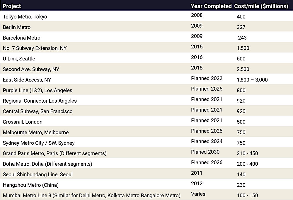
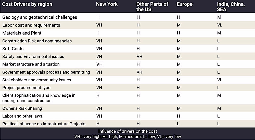

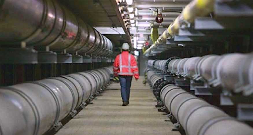
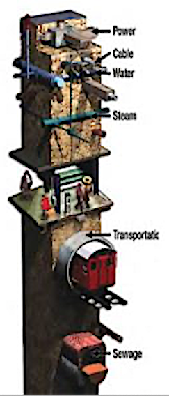



 Research suggests that living 5-10m below the surface provides a relatively stable climate with comfortable temperatures throughout the year, for example around 18 or 19 degrees in most Australian cities.
